MyTopo
Arlington Kentucky US Topo Map
Couldn't load pickup availability
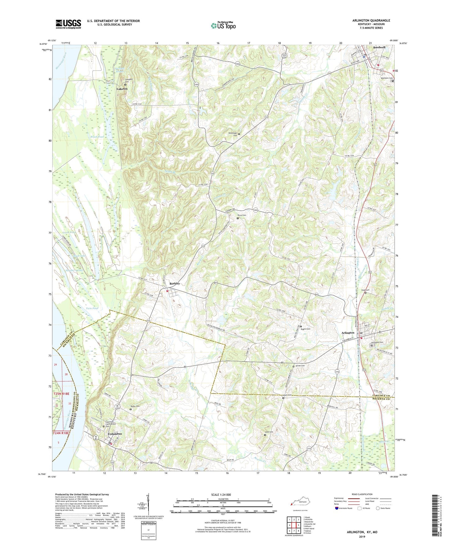
2022 topographic map quadrangle Arlington in the states of Kentucky, Missouri. Scale: 1:24000. Based on the newly updated USGS 7.5' US Topo map series, this map is in the following counties: Carlisle, Hickman, Mississippi. The map contains contour data, water features, and other items you are used to seeing on USGS maps, but also has updated roads and other features. This is the next generation of topographic maps. Printed on high-quality waterproof paper with UV fade-resistant inks.
Quads adjacent to this one:
West: Wickliffe SW
Northwest: Wyatt
North: Wickliffe
Northeast: Blandville
East: Milburn
Southeast: Clinton
South: Oakton
Southwest: Wolf Island
Contains the following named places: Allen Cemetery, Allred Cemetery, Arlington, Arlington Cemetery, Arlington Fire Department / City Hall, Arlington Post Office, Back Slough, Bardwell, Bardwell Division, Bardwell Fire Department, Bardwell Police Department, Bardwell Post Office, Beech Grove, Beech Grove Church, Belmont Landing, Belmont Revetment, Berkley, Berkley Fire Department, Black Lake, Brush Pond, Caddle Creek, Campbell Cemetery, Caney Creek, Carlisle County Ambulance Service, Carlisle County Rural Rescue and Fire, City of Arlington, City of Bardwell, City of Columbus, Columbus, Columbus Confederate Cemetery, Columbus Fire Department, Columbus Post Office, Columbus-Belmont State Park, Crooked Lake, Dicus Cemetery, Fish Lake, Forked Lake, Geveden, Goose Pond, Hurricane Creek, Indian Camp Lake, Laketon, Long Creek, Mississippi, Mississippi Cemetery, Number 4 Lake, Oak Grove School, Rogers Cemetery, Roselawn Cemetery, Sandy Branch, Straight Slough, Taylor Cemetery, Twin Pond, WDKA-TV (Paducah), Webbs Chapel, Zook Cemetery, ZIP Codes: 42021, 42032