MyTopo
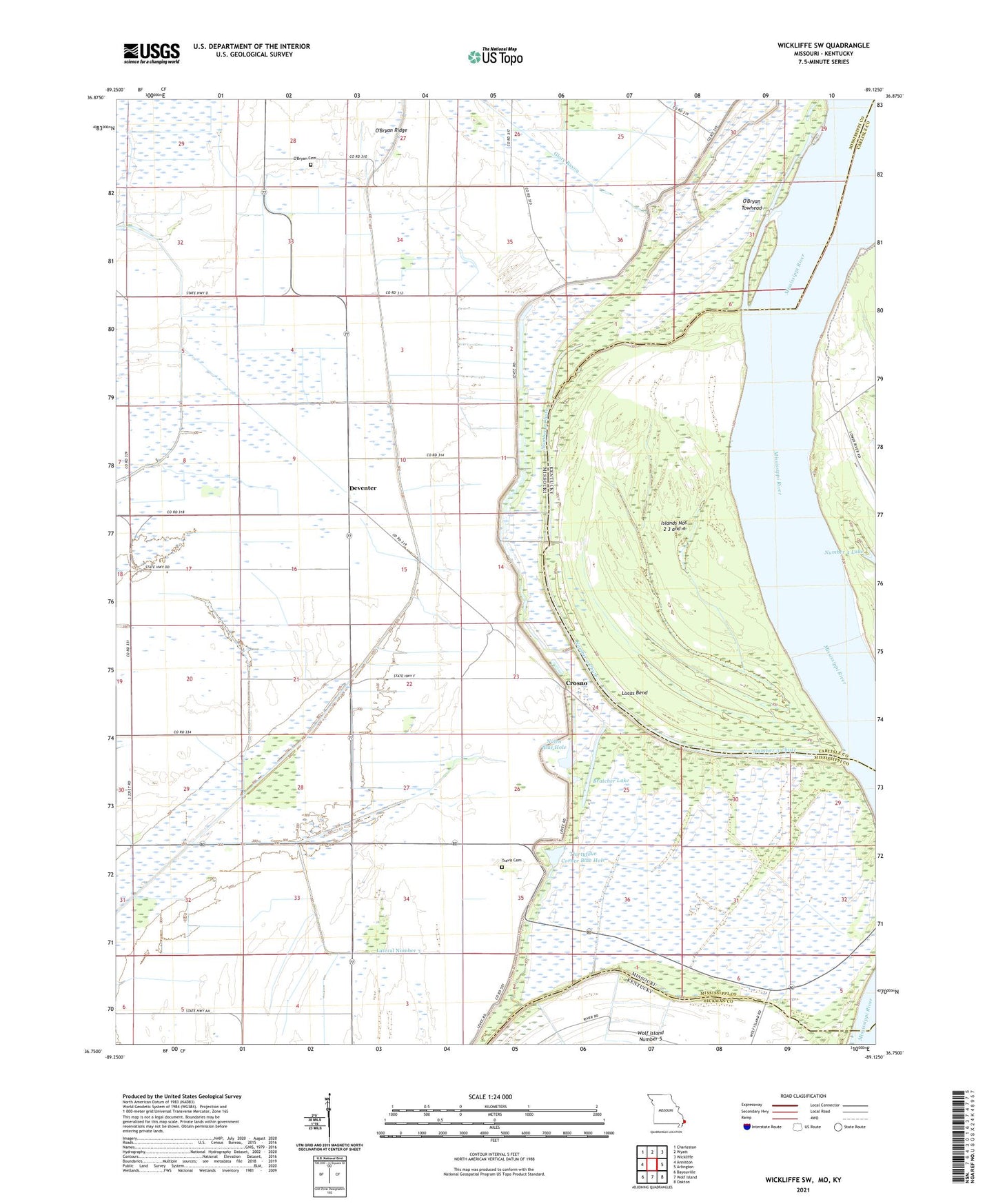
Wickliffe SW Missouri US Topo Map
Couldn't load pickup availability
2021 topographic map quadrangle Wickliffe SW in the states of Missouri, Kentucky. Scale: 1:24000. Based on the newly updated USGS 7.5' US Topo map series, this map is in the following counties: Mississippi, Carlisle, Hickman. The map contains contour data, water features, and other items you are used to seeing on USGS maps, but also has updated roads and other features. This is the next generation of topographic maps. Printed on high-quality waterproof paper with UV fade-resistant inks.
Quads adjacent to this one:
West: Anniston
Northwest: Charleston
North: Wyatt
Northeast: Wickliffe
East: Arlington
Southeast: Oakton
South: Wolf Island
Southwest: Bayouville
This map covers the same area as the classic USGS quad with code o36089g2.
Contains the following named places: Barnell Lake, Belmont, Bratcher Lake, Cambells Landing, Crosno, Crosno School, Deventer, Deventer Church, Deventer School, Dirk Goodin School, Dirk School, Fuget, Glory Bayou, Halloway Church, Halloway School, Islands Nos 2 3 and 4, Lateral Number 1, Lateral Number 3, Lower Crosno Church, Lower Crosno School, Lucas Bend, Lucas Landing, McFadden Landing, Miller Landing, Mount Hope Church, New Madrid Floodway, Nolen Blue Hole, Number 3 Chute, O'Bryan Cemetery, O'Bryan Landing, O'Bryan Ridge, O'Bryan Towhead, Thirty Four Corner School, Thirtyfour Corner, Thirtyfour Corner Blue Hole, Township of Mississippi, Travis Cemetery