MyTopo
Wickliffe Kentucky US Topo Map
Couldn't load pickup availability
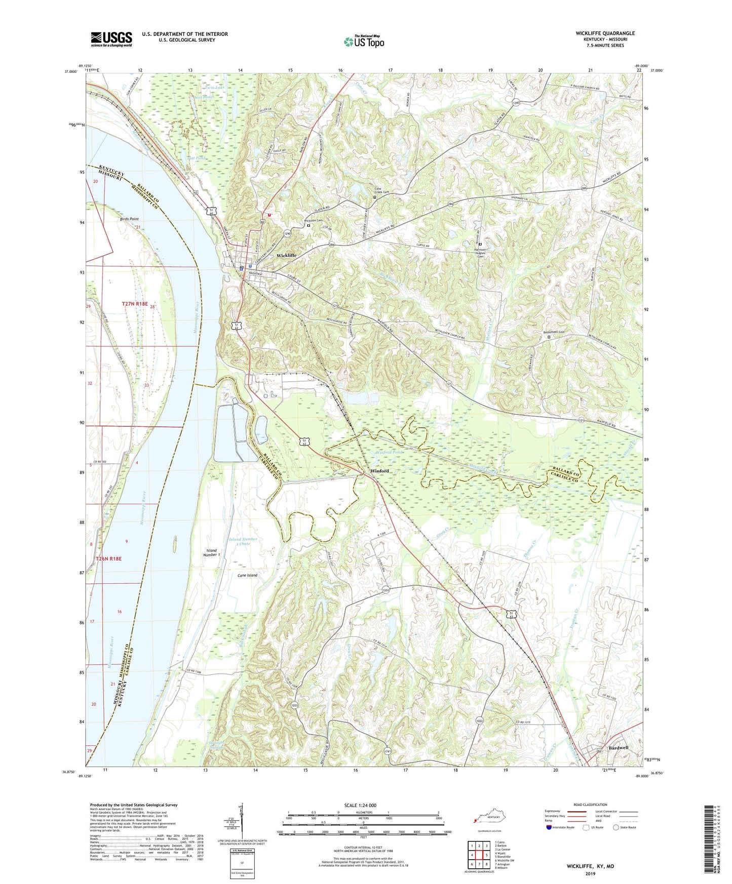
2022 topographic map quadrangle Wickliffe in the states of Kentucky, Missouri. Scale: 1:24000. Based on the newly updated USGS 7.5' US Topo map series, this map is in the following counties: Carlisle, Ballard, Mississippi. The map contains contour data, water features, and other items you are used to seeing on USGS maps, but also has updated roads and other features. This is the next generation of topographic maps. Printed on high-quality waterproof paper with UV fade-resistant inks.
Quads adjacent to this one:
West: Wyatt
Northwest: Cairo
North: Barlow
Northeast: La Center
East: Blandville
Southeast: Milburn
South: Arlington
Southwest: Wickliffe SW
Contains the following named places: Back Slough, Ballard County Sheriff's Office, Bethlehem Cemetery, Bethlehem Church, Birds Point, Buckheart Creek, Cane Island, Central Creek, City of Wickliffe, Cone Creek Cemetery, Cone Creek Church, Fillmore, Flat Pond, Gray Creek, Harrison - Hughes Cemetery, Island Number 1, Island Number 1 Chute, Lost Pond, Mayfield Creek, Norfolk, Norfolk Landing, North Ballard Church, Pritchard Landing, Pritchard Revetment, Shelton Creek, Stovall Creek, Thomas Creek, Towhead of Island Number One, Truman Creek, WBCE-AM (Wickliffe), Wickliffe, Wickliffe Cemetery, Wickliffe Fire Department, Wickliffe Police Department, Wickliffe Post Office, Winford, Winford Pond