MyTopo
Blandville Kentucky US Topo Map
Couldn't load pickup availability
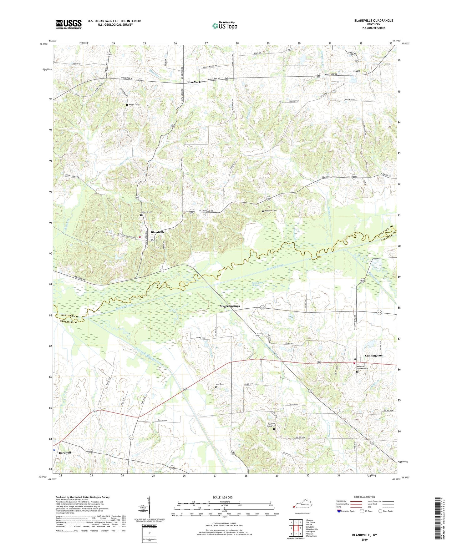
2022 topographic map quadrangle Blandville in the state of Kentucky. Scale: 1:24000. Based on the newly updated USGS 7.5' US Topo map series, this map is in the following counties: Carlisle, Ballard. The map contains contour data, water features, and other items you are used to seeing on USGS maps, but also has updated roads and other features. This is the next generation of topographic maps. Printed on high-quality waterproof paper with UV fade-resistant inks.
Quads adjacent to this one:
West: Wickliffe
Northwest: Barlow
North: La Center
Northeast: Heath
East: Lovelaceville
Southeast: Fancy Farm
South: Milburn
Southwest: Arlington
This map covers the same area as the classic USGS quad with code o36088h8.
Contains the following named places: Blandville, Blandville Fire Department, Buckler Creek, Carlisle County Sheriff's Office, City of Blandville, Coon Branch, Cunningham, Cunningham Census Designated Place, Cunningham Division, Cunningham Fire Department, Cunningham Memorial Garden, Cunningham Post Office, Gage, Garner Branch, Hall Cemetery, Hillcrest Cemetery, Hurricane Creek, Magee Springs, Martin Cemetery, Mayfield Creek Cemetery, Mayfield Creek Church, Morris Valley, Morris Valley Church, New York, Old Mayfield, Robinson Cemetery, Ross Crossing, Saint Arbor Slough, Shady Grove Church, West Fork Mayfield Creek, WGKY-FM (Wickliffe), Wickliffe Division, Wilson Creek, ZIP Code: 42087