MyTopo
Barlow Kentucky US Topo Map
Couldn't load pickup availability
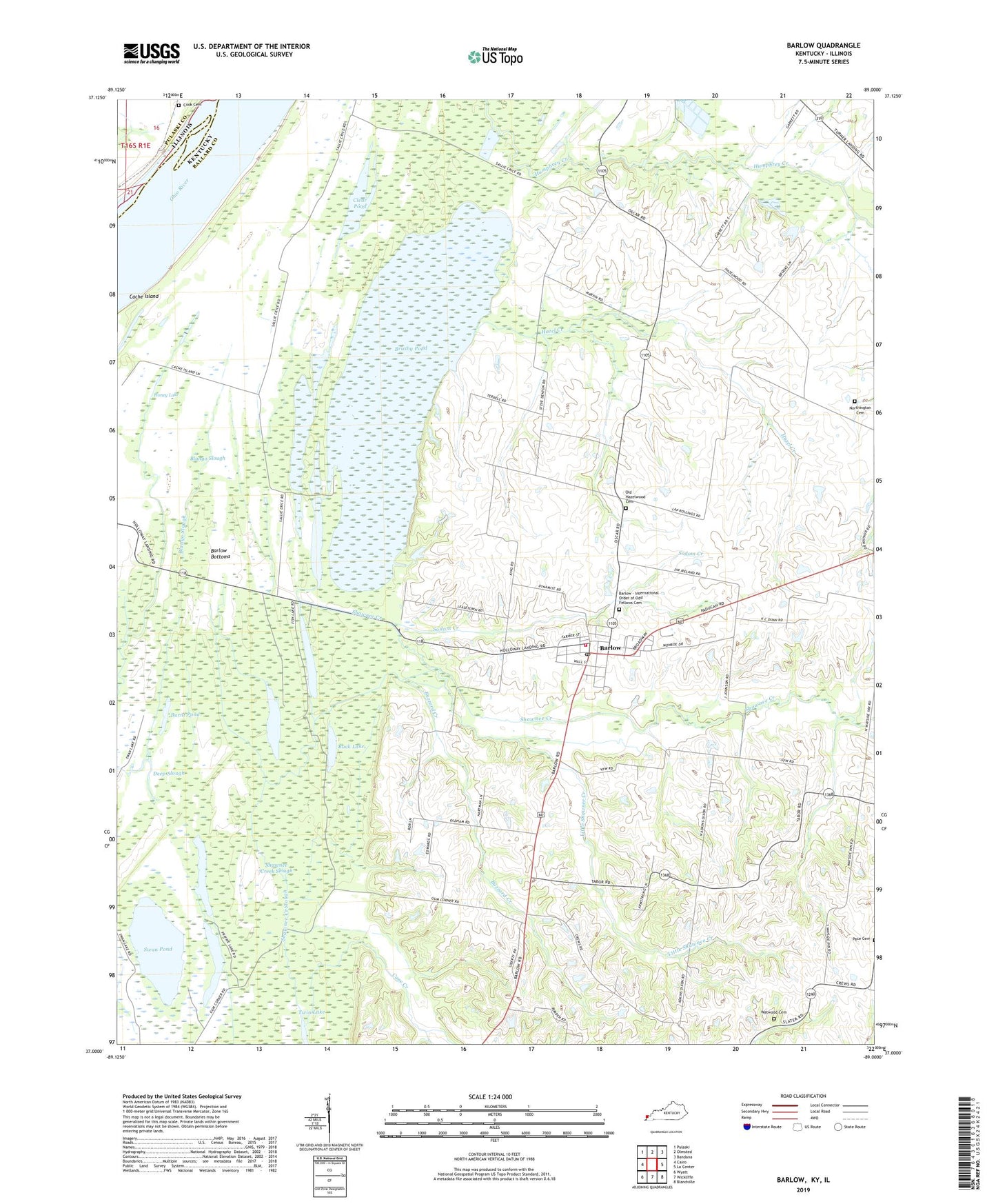
2022 topographic map quadrangle Barlow in the states of Kentucky, Illinois. Scale: 1:24000. Based on the newly updated USGS 7.5' US Topo map series, this map is in the following counties: Ballard, Pulaski. The map contains contour data, water features, and other items you are used to seeing on USGS maps, but also has updated roads and other features. This is the next generation of topographic maps. Printed on high-quality waterproof paper with UV fade-resistant inks.
Quads adjacent to this one:
West: Cairo
Northwest: Pulaski
North: Olmsted
Northeast: Bandana
East: La Center
Southeast: Blandville
South: Wickliffe
Southwest: Wyatt
This map covers the same area as the classic USGS quad with code o37089a1.
Contains the following named places: Axe Lake, Ballard Wildlife Management Area, Barlow, Barlow - International Order of Odd Fellows Cemetery, Barlow Bottoms, Barlow Division, Barlow Fire Department, Barlow Post Office, Barlow Rural Fire Department, Bethel Church, Blango Slough, Brushy Pond, Buck Lake, Burnt Pond, Buzzard Creek, Cane Creek, City of Barlow, Clear Lake, Clear Pond, Cook Cemetery, Deep Slough, Fish Lake, Flat Lake, Hazel Creek, Honey Lake, Hunters Pond, King Creek, Liberty Church, Little Brushy Pond, Little Shawnee Creek, Northington Cemetery, Ohio Valley Church, Old Hazelwood Cemetery, Prairie Lake, Shawnee Creek, Shawnee Creek Slough, Sodom Creek, Swan Pond, Tupelo Pond, Twin Lake, Watwood Cemetery, ZIP Code: 42024