MyTopo
La Center Kentucky US Topo Map
Couldn't load pickup availability
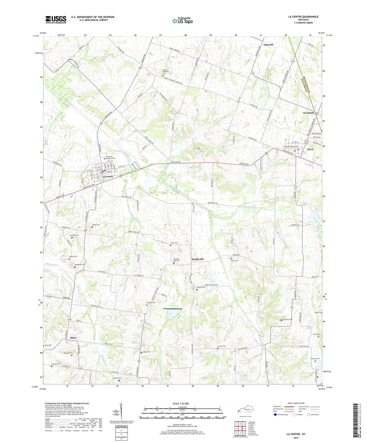
2022 topographic map quadrangle La Center in the state of Kentucky. Scale: 1:24000. Based on the newly updated USGS 7.5' US Topo map series, this map is in the following counties: Ballard, McCracken. The map contains contour data, water features, and other items you are used to seeing on USGS maps, but also has updated roads and other features. This is the next generation of topographic maps. Printed on high-quality waterproof paper with UV fade-resistant inks.
Quads adjacent to this one:
West: Barlow
Northwest: Olmsted
North: Bandana
Northeast: Joppa
East: Heath
Southeast: Lovelaceville
South: Blandville
Southwest: Wickliffe
This map covers the same area as the classic USGS quad with code o37088a8.
Contains the following named places: Antioch Cemetery, Antioch Church, Ballard County, Ballard County Ambulance Services, Ballard Memorial School, Bethel Cemetery, Bethel Cumberland Presbyterian Church, Blank Cemetery, City of Kevil, City of La Center, Criswell Cemetery, Dam Number 3-A, Henderson Cemetery, Hines Cemetery, Hinkle Creek, Hinkleville, Hook Cemetery, Humphrey Branch, Humphrey Slough, Ingleside, Jackson Cemetery, Jenkins Cemetery, Kevil, Kevil Fire Department, Kevil Post Office, La Center, La Center Division, La Center Fire Department, La Center Gardens Cemetery, La Center Police Department, La Center Post Office, La Center Rural Fire Department, Little Humphrey Creek, Lockhart Cemetery, Lucy Creek, Mount Pleasant Cemetery, Mount Pleasant Church, Newman Cemetery, Newton Cemetery, Oak Grove Church, O'Donely Cemetery, Pace Cemetery, Pleasant Hill Cemetery, Pleasant Hill Church, Pollock Cemetery, Skinner Cemetery, Slater, Terrell Cemetery, Vance Cemetery, ZIP Codes: 42053, 42056