MyTopo
Beech Grove Kentucky US Topo Map
Couldn't load pickup availability
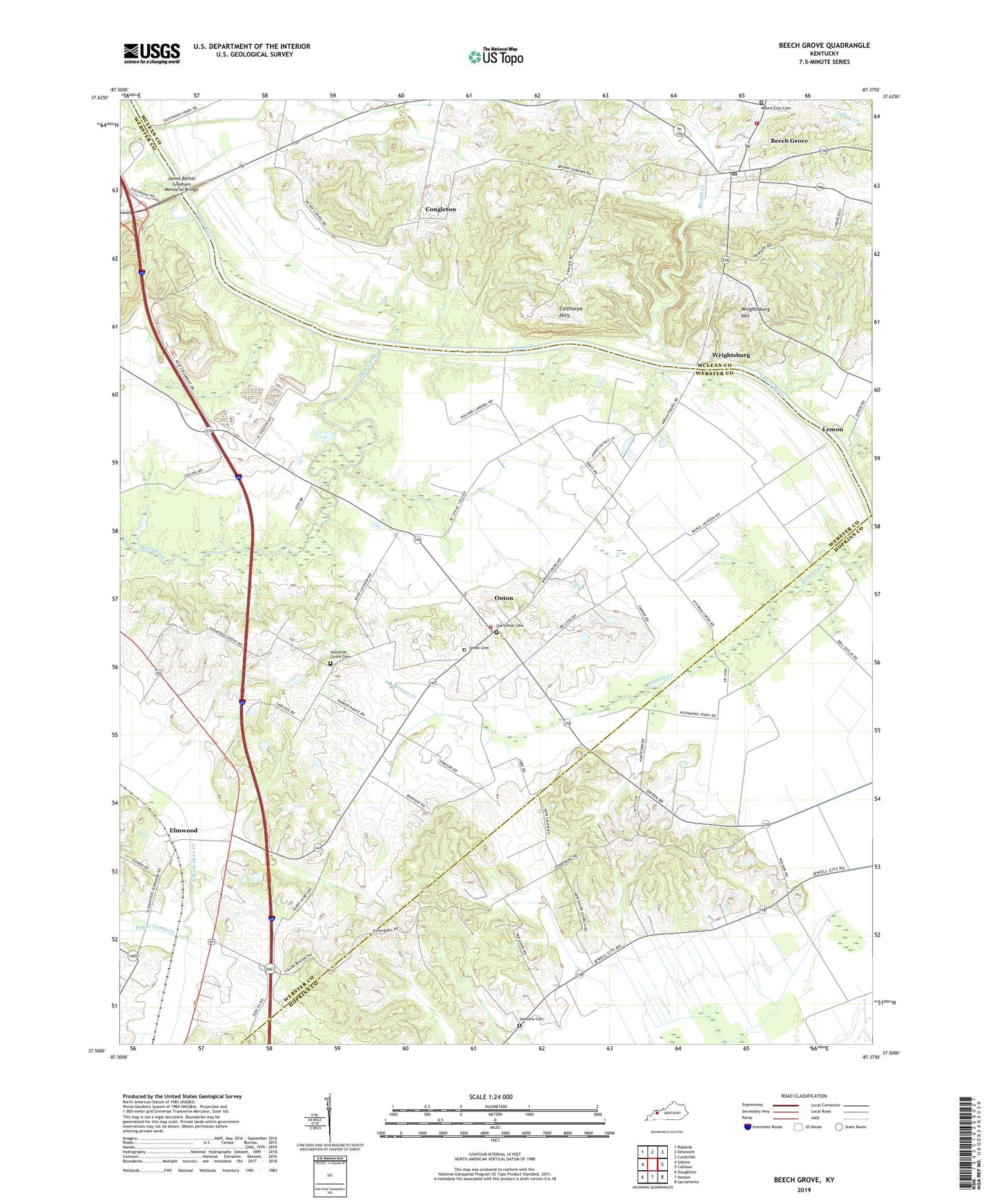
2022 topographic map quadrangle Beech Grove in the state of Kentucky. Scale: 1:24000. Based on the newly updated USGS 7.5' US Topo map series, this map is in the following counties: Webster, McLean, Hopkins. The map contains contour data, water features, and other items you are used to seeing on USGS maps, but also has updated roads and other features. This is the next generation of topographic maps. Printed on high-quality waterproof paper with UV fade-resistant inks.
Quads adjacent to this one:
West: Sebree
Northwest: Robards
North: Delaware
Northeast: Curdsville
East: Calhoun
Southeast: Sacramento
South: Hanson
Southwest: Slaughters
This map covers the same area as the classic USGS quad with code o37087e4.
Contains the following named places: Beech Grove, Beech Grove Census Designated Place, Beech Grove Chapel, Beech Grove Post Office, Beech Grove Volunteer Fire Department, Chelsea, Coltharpe Hills, Congleton, Deer Creek, Elmwood, James Bethel Gresham Memorial Bridge, Lemon, Mason Creek, Mount Zion Cemetery, New Salem, New Salem Church, Old Onton Cemetery, Onton, Onton Cemetery, Onton Census Designated Place, Onton Fire Department, Roland Landing, Samuels Cemetery, Sassafras Grove Cemetery, Sassafras Grove Methodist Church, Steamport Landing, Sugar Camp Creek, Wrightsburg, Wrightsburg Hill, Yellow Creek, ZIP Codes: 42322, 42456