MyTopo
Bradfordsville NE Kentucky US Topo Map
Couldn't load pickup availability
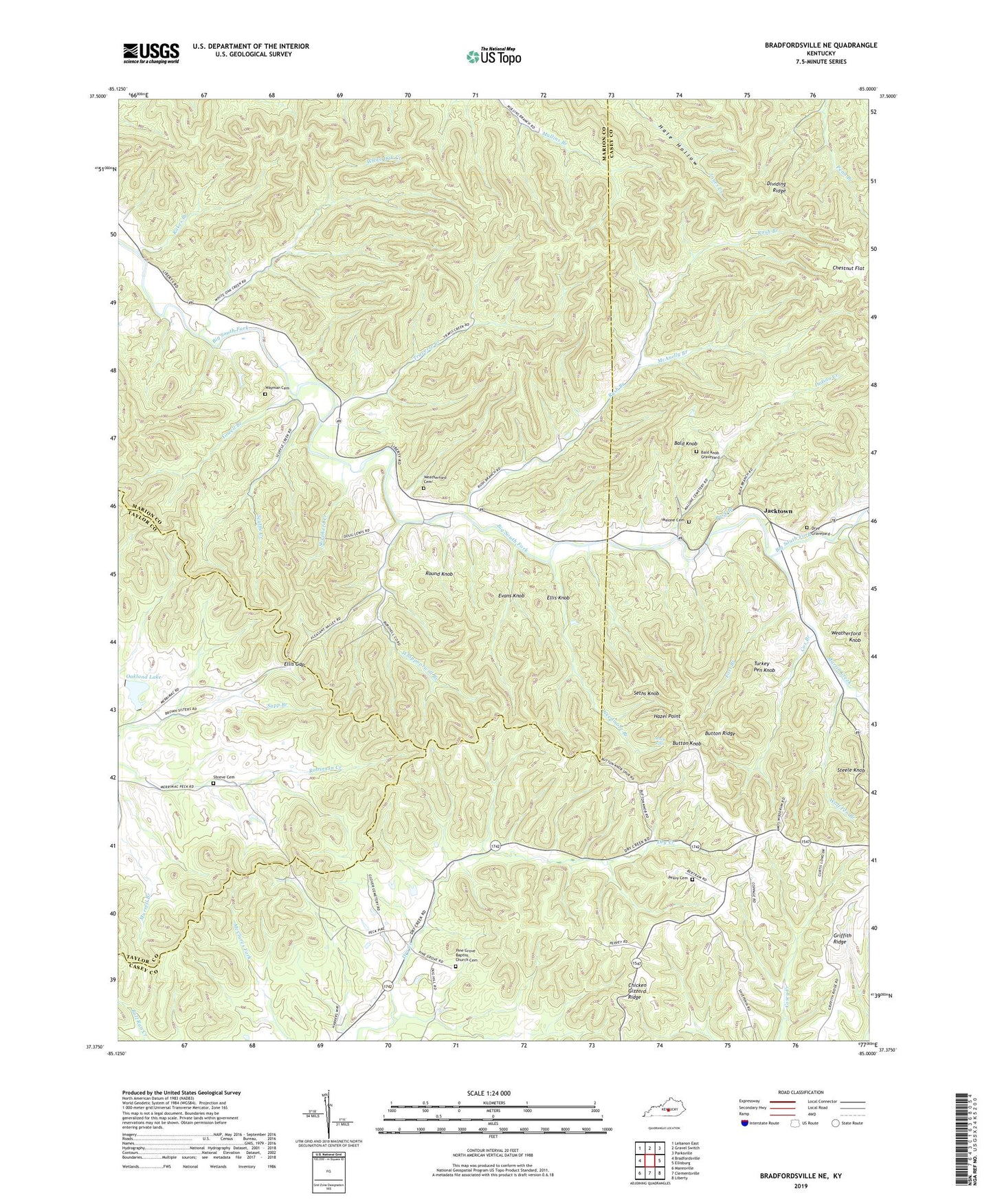
2022 topographic map quadrangle Bradfordsville NE in the state of Kentucky. Scale: 1:24000. Based on the newly updated USGS 7.5' US Topo map series, this map is in the following counties: Casey, Marion, Taylor. The map contains contour data, water features, and other items you are used to seeing on USGS maps, but also has updated roads and other features. This is the next generation of topographic maps. Printed on high-quality waterproof paper with UV fade-resistant inks.
Quads adjacent to this one:
West: Bradfordsville
Northwest: Lebanon East
North: Gravel Switch
Northeast: Parksville
East: Ellisburg
Southeast: Liberty
South: Clementsville
Southwest: Mannsville
This map covers the same area as the classic USGS quad with code o37085d1.
Contains the following named places: Atwood School, Bald Knob, Bald Knob Graveyard, Bradfordsville Division, Buck Branch, Button Knob, Button Knob Lookout Tower, Button Ridge, Chestnut Flat, Chestnut Grove Church, Cox Branch, Drye Graveyard, Ellis Gap, Ellis Knob, Evans Knob, Fort Branch, Griffith Ridge, Griffith School, Hale Hollow, Hazel Point, Indian Creek, Jacktown, Malone Cemetery, Martin Creek, McAnelly Branch, McFarland School, Needmore Branch, Oakland Lake, Peavy Cemetery, Peck Post Office, Pine Grove, Pine Grove Baptist Church Cemetery, Pine Grove School, Pleasant Valley Church, Rakes Branch, Round Knob, Rush Branch, Rush Branch Post Office, Scuffle Creek, Seths Knob, Shepherd Creek, Shreve Cemetery, South Fork Church, Stacy Falls, Steele Knob, Traverse Creek, Turkey Pen Knob, Wayman Cemetery, Weatherford Cemetery, Wess Post Office, Whippoorwill, Whippoorwill Branch, White Oak Creek, Wolf Pen Branch, Yowell Branch, ZIP Code: 40009