MyTopo
Campbellsville Kentucky US Topo Map
Couldn't load pickup availability
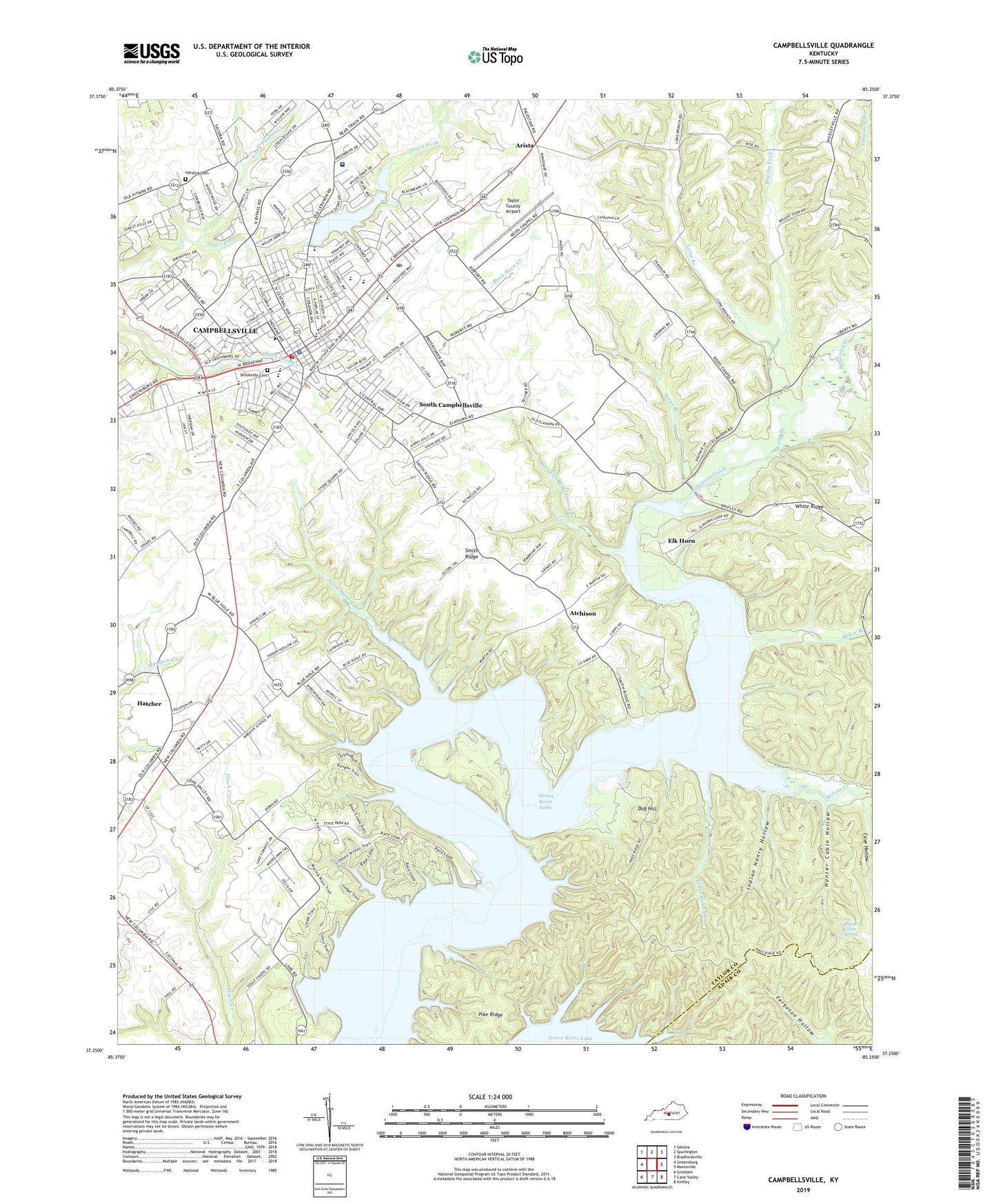
2022 topographic map quadrangle Campbellsville in the state of Kentucky. Scale: 1:24000. Based on the newly updated USGS 7.5' US Topo map series, this map is in the following counties: Taylor, Adair. The map contains contour data, water features, and other items you are used to seeing on USGS maps, but also has updated roads and other features. This is the next generation of topographic maps. Printed on high-quality waterproof paper with UV fade-resistant inks.
Quads adjacent to this one:
West: Greensburg
Northwest: Saloma
North: Spurlington
Northeast: Bradfordsville
East: Mannsville
Southeast: Knifley
South: Cane Valley
Southwest: Gresham
This map covers the same area as the classic USGS quad with code o37085c3.
Contains the following named places: Arista, Atchison, Baker Branch, Bethel Church, Brookside Cemetery, Brushy Fork, Campbellsville, Campbellsville - Taylor County Ambulance Service, Campbellsville Baptist Church Historical Marker, Campbellsville City Reservoir, Campbellsville College Historical Marker, Campbellsville Division, Campbellsville Fire Department, Campbellsville Historical Marker, Campbellsville Police Department, Campbellsville Post Office, Campbellsville University, Cave Hollow, City of Campbellsville, Civil War Court House Burnings Historical Marker, Cumberland Trace Historical Marker, Dug Hill, Durham School, Elias Barbee Historical Marker, Elk Horn, Elkhorn Church, Green River Lake State Park, Green River Memorial Church, Harding Cemetery, Hatcher, Hunter Cabin Hollow, Hunters Cabin Spring, Indian Henry Hollow, John Hunt Morgan Raids Historical Marker, Kentucky Division of Forestry South Central District, Liberty-Cumberland Church, Little Wilson Creek, Long Branch, Lowell Avenue Church, Marks Church, Mount Zion Church, Reed Chapel, Robinson Creek, Robinson Creek Church, Saint Andrews Church, Shady Grove Church, Smith Ridge, Soule Chapel, South Campbellsville, Sprat Branch, Stone Quarry Creek, Stoner Creek, Taylor County, Taylor County Airport, Taylor County Fire Department, Taylor County High School, Taylor County Hospital, Taylor County Park, Taylor County School, Taylor County Sheriff's Department, Trace Fork, Wee Yan Branch Robinson Creek, Wilson Creek, Woodlawn Christian Church