MyTopo
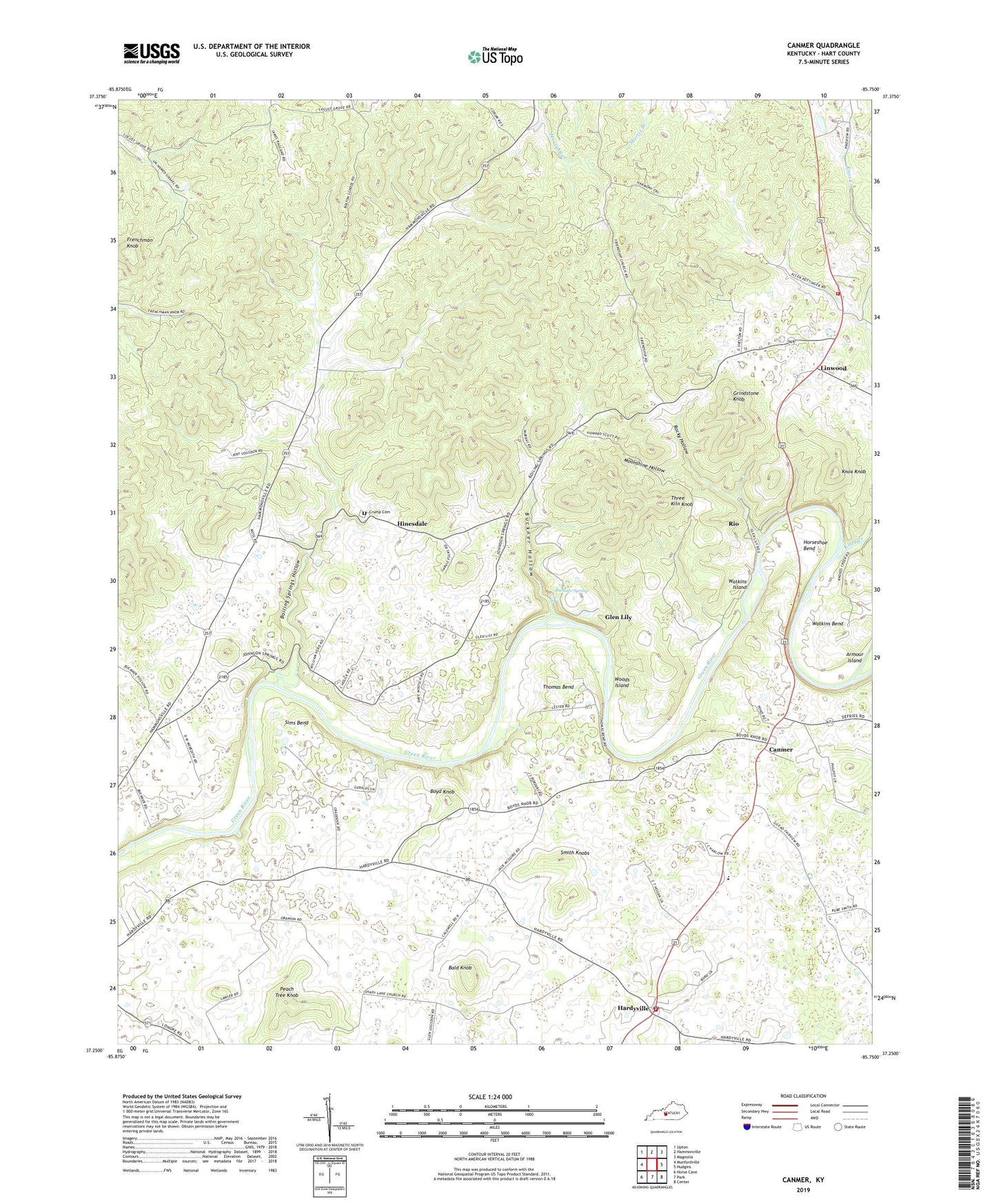
Canmer Kentucky US Topo Map
Couldn't load pickup availability
2022 topographic map quadrangle Canmer in the state of Kentucky. Scale: 1:24000. Based on the newly updated USGS 7.5' US Topo map series, this map is in the following counties: Hart. The map contains contour data, water features, and other items you are used to seeing on USGS maps, but also has updated roads and other features. This is the next generation of topographic maps. Printed on high-quality waterproof paper with UV fade-resistant inks.
Quads adjacent to this one:
West: Munfordville
Northwest: Upton
North: Hammonville
Northeast: Magnolia
East: Hudgins
Southeast: Center
South: Park
Southwest: Horse Cave
This map covers the same area as the classic USGS quad with code o37085c7.
Contains the following named places: Bald Knob, Boiling Springs Church, Boiling Springs Hollow, Bolton Church, Boyd Knob, Buckner Hollow, Buckner Spring, Canmer, Early Gunpowder Mill Historical Marker, Frenchman Knob, Frenchman Knob Church, Friendship Church, Gilead Church, Glen Lily, Glen Lily Church, Grindstone Knob, Hammonville Division, Hardyville, Hardyville Census Designated Place, Hardyville Fire Department, Hardyville Post Office, Hinesdale, Horseshoe Bend, Knox Creek, Knox Knob, Linwood, Linwood Volunteer Fire Department, Memorial Elementary School, Moonshine Hollow, Old Linwood, Peach Tree Knob, Ray Island, Rio, Rocky Hollow, Sims Bend, Smith Knobs, Thomas Bend, Three Kiln Knob, Timberlake Cemetery, Watkins Bend, Watkins Island, Woods Island