MyTopo
Dalton Kentucky US Topo Map
Couldn't load pickup availability
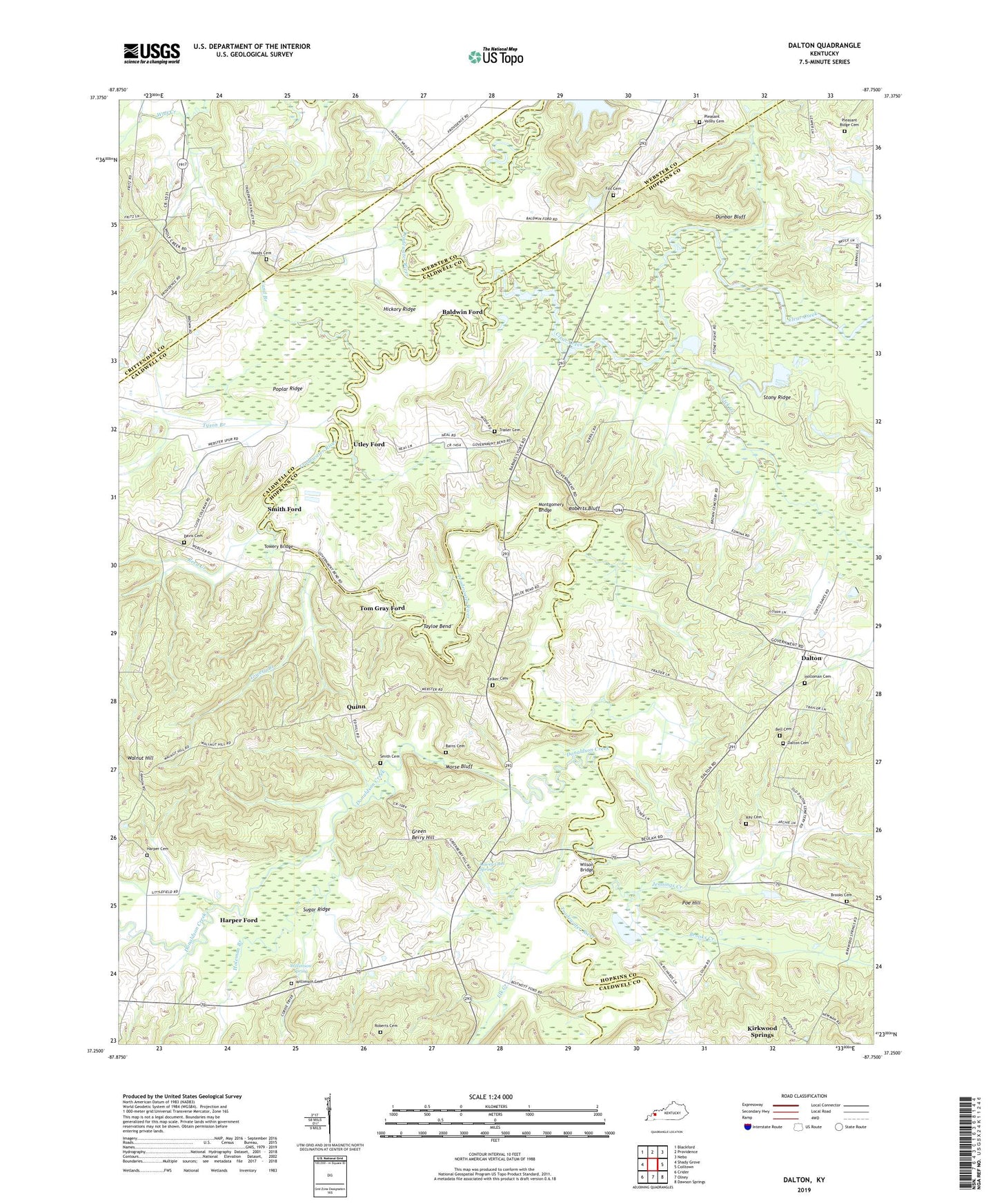
2022 topographic map quadrangle Dalton in the state of Kentucky. Scale: 1:24000. Based on the newly updated USGS 7.5' US Topo map series, this map is in the following counties: Hopkins, Caldwell, Crittenden, Webster. The map contains contour data, water features, and other items you are used to seeing on USGS maps, but also has updated roads and other features. This is the next generation of topographic maps. Printed on high-quality waterproof paper with UV fade-resistant inks.
Quads adjacent to this one:
West: Shady Grove
Northwest: Blackford
North: Providence
Northeast: Nebo
East: Coiltown
Southeast: Dawson Springs
South: Olney
Southwest: Crider
This map covers the same area as the classic USGS quad with code o37087c7.
Contains the following named places: Baldwin Ford, Barnes Cemetery, Beech Grove Church, Bell Cemetery, Brooks Cemetery, Brooks Creek, Clear Creek, Dalton, Dalton Cemetery, Dalton Church, Davis Cemetery, Donaldson Creek, Dunbar Bluff, Elk Creek, Felker Cemetery, Fox Cemetery, Fryer, Green Berry Hill, Harper Cemetery, Harper Ford, Hart and Hart Mine, Hickory Ridge, Holeman Branch, Holloman Cemetery, Hoods Cemetery, Jennings Creek, Kirkwood Springs, Land Branch, Lick Creek, Lowey Gum Spring, Montgomery Bridge, Morse Bluff, Mount Olivet Church, New Hope Church, Pleasant Ridge Cemetery, Pleasant Valley Cemetery, Pleasant Valley Church, Poe Hill, Poplar Ridge, Prospect Church, Providence City Lake, Quinn, Ray Cemetery, Reed Creek, Roberts Bluff, Roberts Cemetery, Shady Grove, Smith Cemetery, Smith Ford, Stoney Point Mines, Stony Point Church, Strip Mine, Sugar Ridge, Tayloe Bend, Tom Gray Ford, Towery Branch, Towery Bridge, Tradewater Valley Church, Trailer Cemetery, Tyson Branch, Utley Ford, Walnut Hill, Williamson Cemetery, Willimson Spring, Wilson Bridge