MyTopo
Olney Kentucky US Topo Map
Couldn't load pickup availability
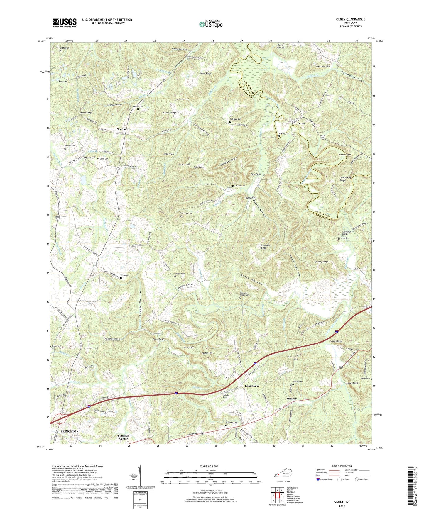
2022 topographic map quadrangle Olney in the state of Kentucky. Scale: 1:24000. Based on the newly updated USGS 7.5' US Topo map series, this map is in the following counties: Caldwell, Hopkins. The map contains contour data, water features, and other items you are used to seeing on USGS maps, but also has updated roads and other features. This is the next generation of topographic maps. Printed on high-quality waterproof paper with UV fade-resistant inks.
Quads adjacent to this one:
West: Crider
Northwest: Shady Grove
North: Dalton
Northeast: Coiltown
East: Dawson Springs
Southeast: Dawson Springs SW
South: Princeton East
Southwest: Princeton West
This map covers the same area as the classic USGS quad with code o37087b7.
Contains the following named places: Bald Knob, Barnes Bluff, Bayles Hollow, Beckner Cemetery, Briarfield, Buffalo Branch, Buzzard Rock Hollow, Caldwell County, Calvert Cemetery Number 2, Carter Hill, Castleberry Ridge, Cave Creek, Cottonpatch Hill, Creekmur Bridge, Creekmur Hill, Crowell Cemetery, Davis Bluff, Deboe Branch, Drennan Cemetery, East Fork Flynn Fork, Fairview Baptist Church, Flynn Fork, Goodaker - McGregor Cemetery, Goodaker Ridge, Goose Creek, Grindstone Branch, Gumlick Branch, Happy Hollow, Hickory Ridge, Holeman Hill, Hunter Bluff, Hunter Cemetery, Hurricane Hollow, Jackson Cemetery, Jackson Hill, Jake Hollow, Jane Nichols Cemetery, Jones Cemetery, Jones Ridge, Jones-Keeney Wildlife Management Area, Lafayette Church, Lamb Cemetery, Lewistown, Lewistown Christian Church, Liberty Cumberland Presbyterian Church, McGregor Cemetery, McNealy Cemetery, Midway, Midway Church, Morse Cemetery Number 2, Morse Ridge, Needmore, Olney, Paddy Bluff, Perry Cemetery, Petes Branch, Phelps Cemetery, Phelps Creek, Pieburn Creek, Pine Bluff, Pooch Hollow, Pratt Creek, Pugh Hollow, Scarberry Cemetery, Sells Hollow, Split Rock, Stallins Cemetery, Stevens Creek, Stillhouse Hollow, Sugar Creek, Sugar Creek Baptist Church, Thomas Bend, Tyrie Mine, Walnut Tree Hill, Ward Creek, Wiley Creek, Witherspoon Cemetery, Young Cemetery, ZIP Code: 42445