MyTopo
Waddy Kentucky US Topo Map
Couldn't load pickup availability
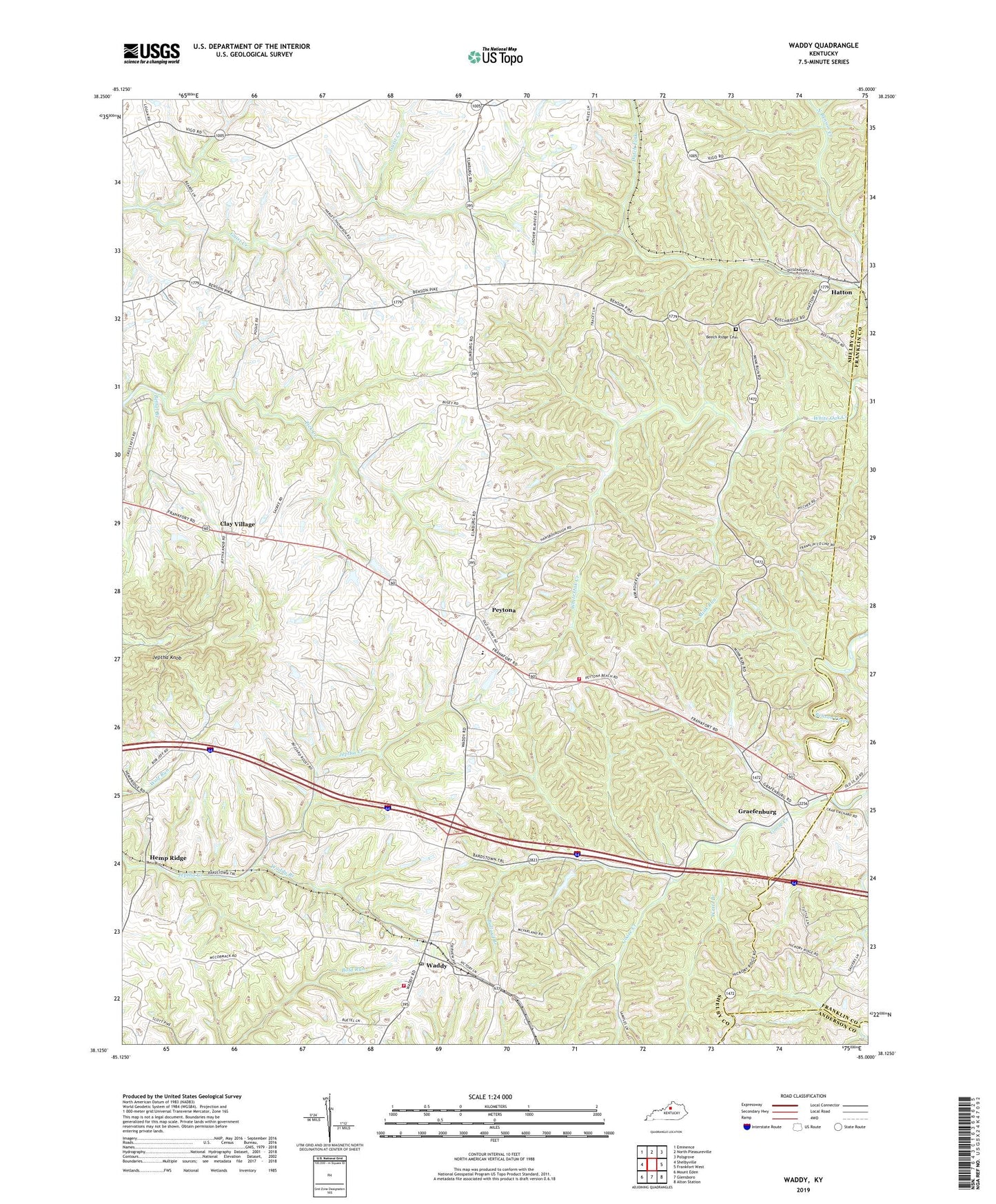
2022 topographic map quadrangle Waddy in the state of Kentucky. Scale: 1:24000. Based on the newly updated USGS 7.5' US Topo map series, this map is in the following counties: Shelby, Franklin, Anderson. The map contains contour data, water features, and other items you are used to seeing on USGS maps, but also has updated roads and other features. This is the next generation of topographic maps. Printed on high-quality waterproof paper with UV fade-resistant inks.
Quads adjacent to this one:
West: Shelbyville
Northwest: Eminence
North: North Pleasureville
Northeast: Polsgrove
East: Frankfort West
Southeast: Alton Station
South: Glensboro
Southwest: Mount Eden
This map covers the same area as the classic USGS quad with code o38085b1.
Contains the following named places: Ashland School, Ballard Branch, Beech Ridge Baptist Church, Beech Ridge Cemetery, Beech Ridge School, Bethel Baptist Church, Bethel Branch, Buffalo Lick Church, Clay Village, Clay Village Post Office, Cold Church, Cross Keys Tavern, Dalton School, Dutch Fork, East 60 Volunteer Fire Department, Gibbs Road, Goose Creek, Graefenburg, Harrisonville Division, Hatton, Hatton Post Office, Hemp Ridge, Hemp Ridge Airport, Hemp Ridge Railroad Station, Hempridge Post Office, Heritage Elementary School, Jeptha Knob, Jepthas Knob Historical Marker, Lawrence Post Office, Lewis and Clark Historical Marker, Little Benson School, Lone Oak School Number Fourteen, Mink Run, North Benson Railroad Station, Peytona, Peytona Post Office, Pleasant View Church, Roberts, Shelby County Poor House, Sulphur Springs School, Tylers Pioneer Station, Waddy, Waddy Branch, Waddy High School, Waddy Post Office, Waddy School, Waddy Volunteer Fire Department, Walnut Grove School, Watts Branch, Wolf Run School