MyTopo
Simpsonville Kentucky US Topo Map
Couldn't load pickup availability
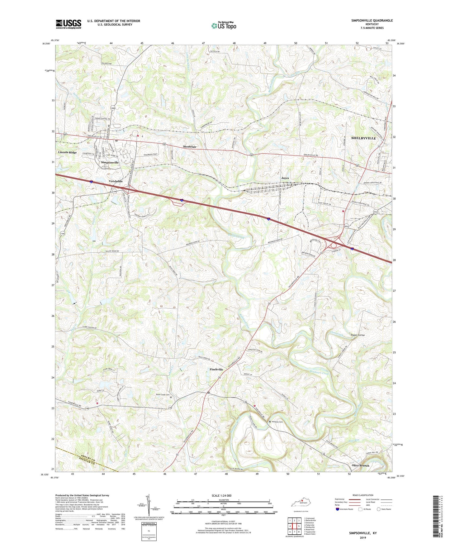
2022 topographic map quadrangle Simpsonville in the state of Kentucky. Scale: 1:24000. Based on the newly updated USGS 7.5' US Topo map series, this map is in the following counties: Shelby, Spencer. The map contains contour data, water features, and other items you are used to seeing on USGS maps, but also has updated roads and other features. This is the next generation of topographic maps. Printed on high-quality waterproof paper with UV fade-resistant inks.
Quads adjacent to this one:
West: Fisherville
Northwest: Crestwood
North: Ballardsville
Northeast: Eminence
East: Shelbyville
Southeast: Mount Eden
South: Taylorsville
Southwest: Waterford
This map covers the same area as the classic USGS quad with code o38085b3.
Contains the following named places: Beechwood Church, Beechwood School, Buck Creek Baptist Church, Buck Creek Cemetery, Buck Creek School, Buck Creek Station, Bullskin Creek, Captain Samuel Wells Station, City of Simpsonville, Clear Creek, Dry Run, Finchs Railroad Station, Finchville, Finchville Christian Church, Finchville Post Office, Finchville School, Fox Run, Gath Railroad Station, Herrington Mills, Joyes, Little Bullskin Creek, Meadow Run, Montclair, Newlands Station, Olive Branch, Olive Branch United Methodist Church, Pickett Railroad Station, Picketts Cemetery, Popes Corner, School Number Twenty-One, Scotts Station, Scotts Station Post Office, Shelby Academy, Shelby County Fire Department Station 2, Shelby County Fire Department Station 4, Shiloh Church, Simpsonville, Simpsonville Division, Simpsonville Fire Department, Simpsonville Post Office, Simpsonville Rural Fire Protection District Station 3, Taggart Railroad Station, Thelma L Stovall Historical Marker, Veechdale, Veechdale Post Office, Veechdale Railroad Station, ZIP Codes: 40022, 40067