MyTopo
Faubush Kentucky US Topo Map
Couldn't load pickup availability
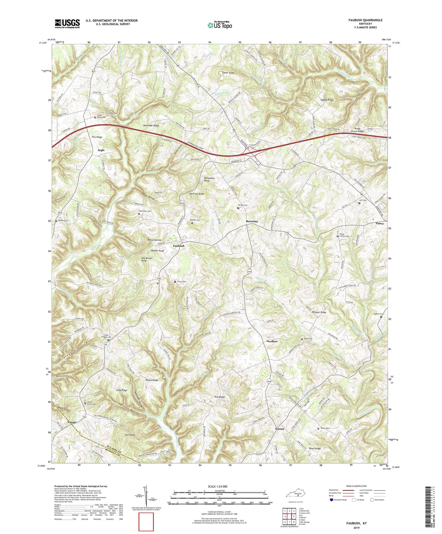
2022 topographic map quadrangle Faubush in the state of Kentucky. Scale: 1:24000. Based on the newly updated USGS 7.5' US Topo map series, this map is in the following counties: Pulaski, Russell. The map contains contour data, water features, and other items you are used to seeing on USGS maps, but also has updated roads and other features. This is the next generation of topographic maps. Printed on high-quality waterproof paper with UV fade-resistant inks.
Quads adjacent to this one:
West: Eli
Northwest: Phil
North: Mintonville
Northeast: Science Hill
East: Delmer
Southeast: Frazer
South: Mill Springs
Southwest: Jabez
This map covers the same area as the classic USGS quad with code o37084a7.
Contains the following named places: Anderson Hollow, Ard Ridge, Barker Knob, Berkett Hollow, Bethlehem Church, Bland Hollow, Bland Ridge, Bray Branch, Burnetta, Burton Branch, Cedar Point Cemetery, Cedar Point Church, Charlie Branch, Chester View Church, Cook Branch, Cook Hollow, Cooks Chapel, Cooks Chapel Cemetery, Cooper Creek, Coplin Branch, Ducky Hollow, Fall Branch, Faubush, Faubush Tri - County Volunteer Fire Department, Floyd Family Cemetery, Grays Chapel, Greasy Hollow, Happy Ridge, Harrison Knob, Hill Knob, Hopeful Church, Hudson Branch, Hudson Cemetery, Ingle, Kisser Branch, Lee Cemetery, Lick Branch, Long Ridge, Mount Zion Church, Nancy Division, Naomi, Newhope Church, Newhope Ridge, Norfleet, Old Brown Knob, Parton Cemetery, Pierce Branch, Piney Grove Church, Pleasant Point Church, Rainwater Branch, Rainwater Cemetery, Rainwater Knob, Rocky Hollow, Shinbone Branch, Siever Knob, Smith Grove Cemetery, Smiths Grove Church, Sputter Branch, Tarter Cemetery, Tick Ridge, Vinnie, Weddle Cemetery, White Oak Creek, Wildcat Ridge, Wilson Cemetery, Wood Cemetery, ZIP Code: 42544