MyTopo
Jabez Kentucky US Topo Map
Couldn't load pickup availability
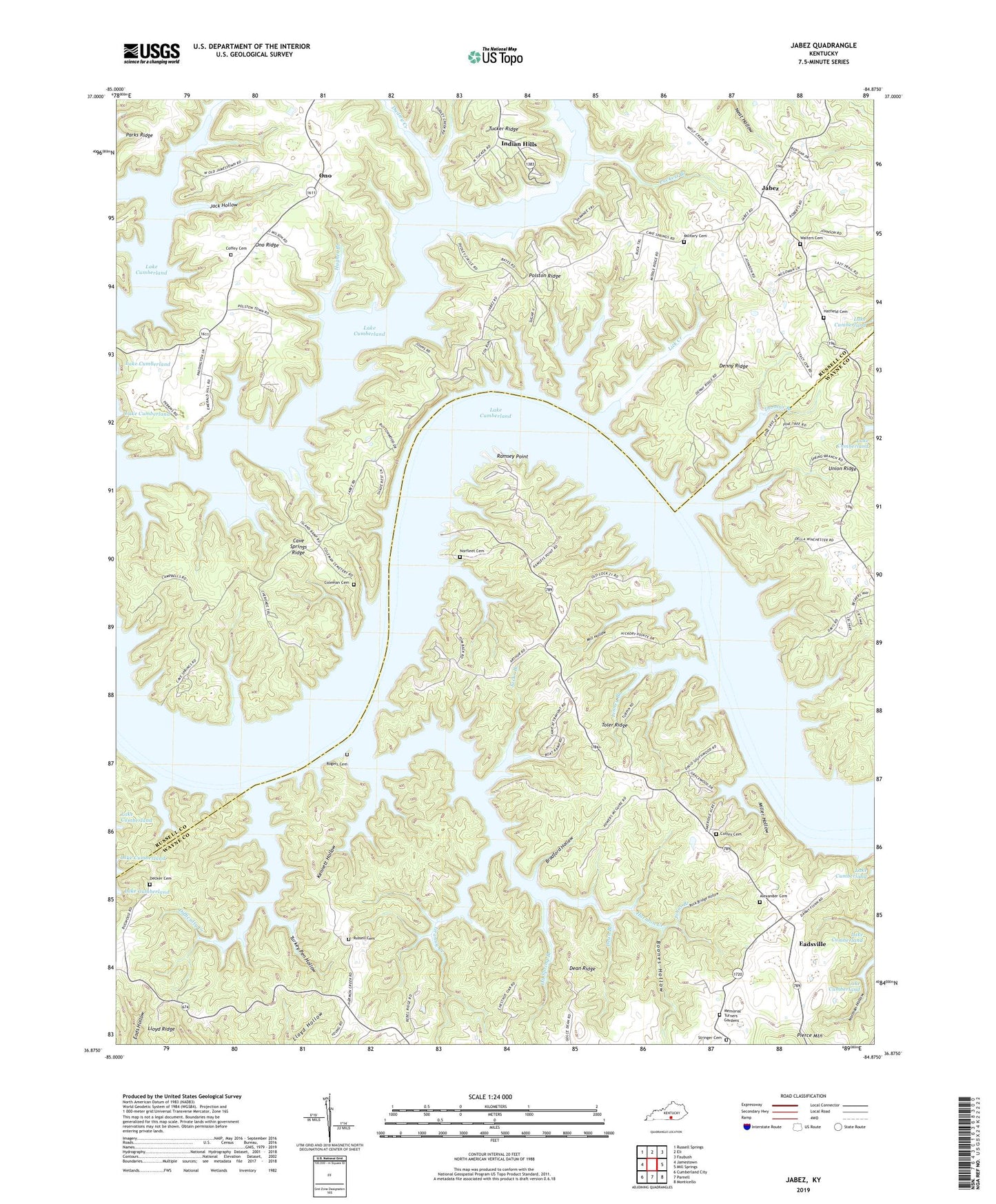
2022 topographic map quadrangle Jabez in the state of Kentucky. Scale: 1:24000. Based on the newly updated USGS 7.5' US Topo map series, this map is in the following counties: Wayne, Russell. The map contains contour data, water features, and other items you are used to seeing on USGS maps, but also has updated roads and other features. This is the next generation of topographic maps. Printed on high-quality waterproof paper with UV fade-resistant inks.
Quads adjacent to this one:
West: Jamestown
Northwest: Russell Springs
North: Eli
Northeast: Faubush
East: Mill Springs
Southeast: Monticello
South: Parnell
Southwest: Cumberland City
This map covers the same area as the classic USGS quad with code o36084h8.
Contains the following named places: Alexander Cemetery, Boones Hollow, Bradford Hollow, Camp Earl Wallace, Caney Fork, Cave Springs Ridge, Cedar Crest Post Office, Coffey Cemetery, Coleman Cemetery, Dean Branch, Dean Ridge, Decker Cemetery, Denny Ridge, Difficulty Creek, Dudley Creek, Eadsville, Granny Creek, Harmon Creek, Hatfield Cemetery, Hughes Branch, Indian Hills, Jabez, Jack Hollow, Jacks Branch, Johns Branch, Kenneth Branch, Kennett Hollow, Lake Valley Church, Lick Creek, Linney Branch, McFarland Creek, Memorial Turners Gardens, Military Spring Cemetery, Mill Hollow, Miller Hollow, Mount Hope Church, Mount Pleasant Church, Norfleet Cemetery, Oil Spring Branch, Ono, Ono Ridge, Parmleys Grove Church, Polston Ridge, Puckett Branch, Ramsey Point, Rock Bridge Hollow, Rogers Cemetery, Russell Cemetery, Square Oak Church, Stringer Cemetery, Thomas Branch, Toler Ridge, Turkey Pen Hollow, Union Ridge, Walters Cemetery, Wolf Creek Recreation Area