MyTopo
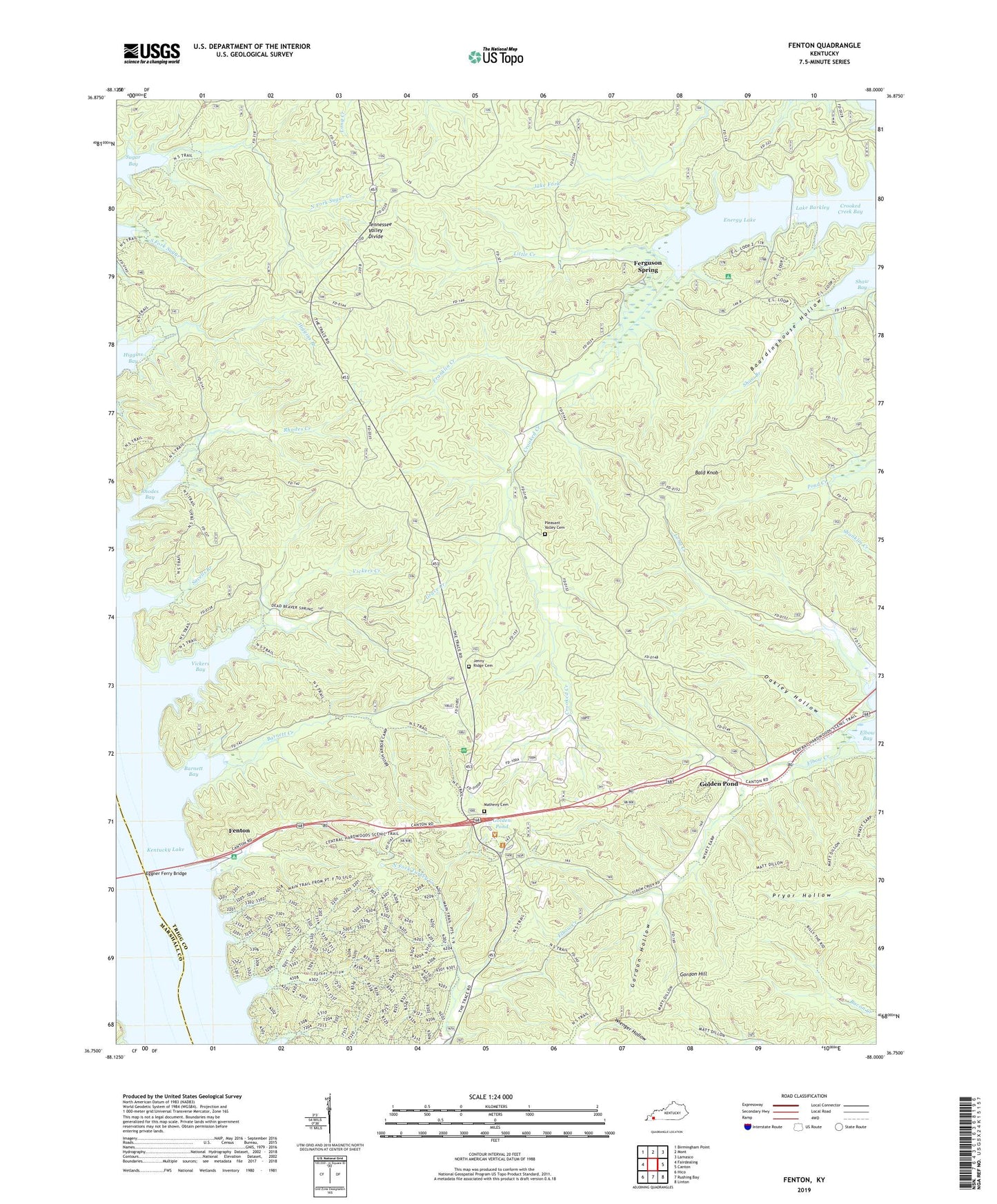
Fenton Kentucky US Topo Map
Couldn't load pickup availability
Also explore the Fenton Forest Service Topo of this same quad for updated USFS data
2022 topographic map quadrangle Fenton in the state of Kentucky. Scale: 1:24000. Based on the newly updated USGS 7.5' US Topo map series, this map is in the following counties: Trigg, Marshall. The map contains contour data, water features, and other items you are used to seeing on USGS maps, but also has updated roads and other features. This is the next generation of topographic maps. Printed on high-quality waterproof paper with UV fade-resistant inks.
Quads adjacent to this one:
West: Fairdealing
Northwest: Birmingham Point
North: Mont
Northeast: Lamasco
East: Canton
Southeast: Linton
South: Rushing Bay
Southwest: Hico
This map covers the same area as the classic USGS quad with code o36088g1.
Contains the following named places: Bald Knob, Barnett Bay, Barnett Creek, Boardinghouse Hollow, Crooked Creek, Crooked Creek Bay, Eggner Ferry Bridge, Elbow Creek, Energy, Energy Lake, Fenton, Ferguson Spring, Franklin Creek, Golden Pond, Gordon Hill, Gordon Hollow, Grace Creek, Higgins Branch, Jenny Ridge Cemetery, Kentucky Woodlands National Wildlife Refuge, Land Between the Lakes Division, Little Creek, Long Creek, Matheny Cemetery, North Fork Sugar Creek, Oakley Hollow, Pleasant Valley Cemetery, Rhodes Bay, Rhodes Creek, Savells Branch, Scout Trail, Shaw Branch, South Fork Sugar Creek, Turner Hollow, Vickers Bay, Vickers Creek