MyTopo
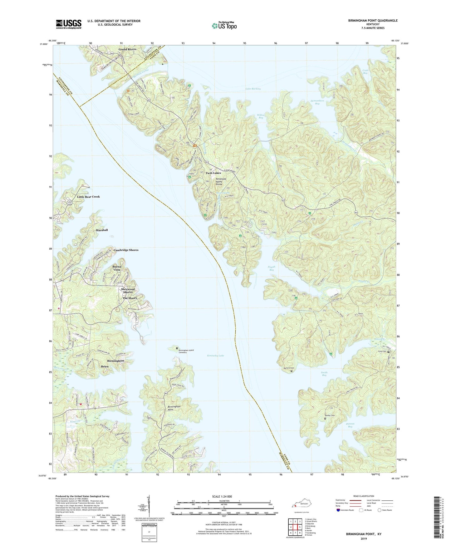
Birmingham Point Kentucky US Topo Map
Couldn't load pickup availability
Also explore the Birmingham Point Forest Service Topo of this same quad for updated USFS data
2022 topographic map quadrangle Birmingham Point in the state of Kentucky. Scale: 1:24000. Based on the newly updated USGS 7.5' US Topo map series, this map is in the following counties: Lyon, Marshall, Livingston, Trigg. The map contains contour data, water features, and other items you are used to seeing on USGS maps, but also has updated roads and other features. This is the next generation of topographic maps. Printed on high-quality waterproof paper with UV fade-resistant inks.
Quads adjacent to this one:
West: Briensburg
Northwest: Calvert City
North: Grand Rivers
Northeast: Eddyville
East: Mont
Southeast: Fenton
South: Fairdealing
Southwest: Hardin
This map covers the same area as the classic USGS quad with code o36088h2.
Contains the following named places: Andrew Jackson Smith Historical Marker, Barkley Canal, Barnett Cemetery, Bear Creek, Bee Spring Camp, Big Bear Camp, Big Bear Creek, Birmingham, Birmingham Ferry Recreation Area, Birmingham Island Cemetery, Birmingham Point, Brien, Brown Spring, Buckhorn Creek, Buena Vista, Cambridge Shores, Camp Cum-Ba-Ya, Camp Currie, Canal Public Use Area, Cap Spring Creek, Crab Bay, Crab Creek, Demumbers Bay, Demumbers Creek, Demumbers Point Recreation Area, Dodds Creek, Duncan Bay, East Marshall Fire Department Station 1, East Marshall Fire Department Station 2, Governor Keen Johnson Historical Marker, Grand Lakes Fire Department Station 1, Hillman Ferry Camping Area, Isaac Gray Cemetery, King Creek, King Creek Camp, Little Bear Creek, Malcolm Creek, Malcolm Creek Camp, Marshall, Moss Creek, Newby Cemetery, Nickell Branch, Nickell Cove, Nickell Point Recreation Area, O'Brien Branch, Paradise Church, Pisgah Bay, Pisgah Creek, Pisgah Point Recreation Area, Seven Mile Island, Sherwood Shores, Smith Bay, Smith Creek, The Moors, Three Mile Island, Twin Lakes, Willow Bay, Willow Creek, Will-Vera Camp