MyTopo
Ford Kentucky US Topo Map
Couldn't load pickup availability
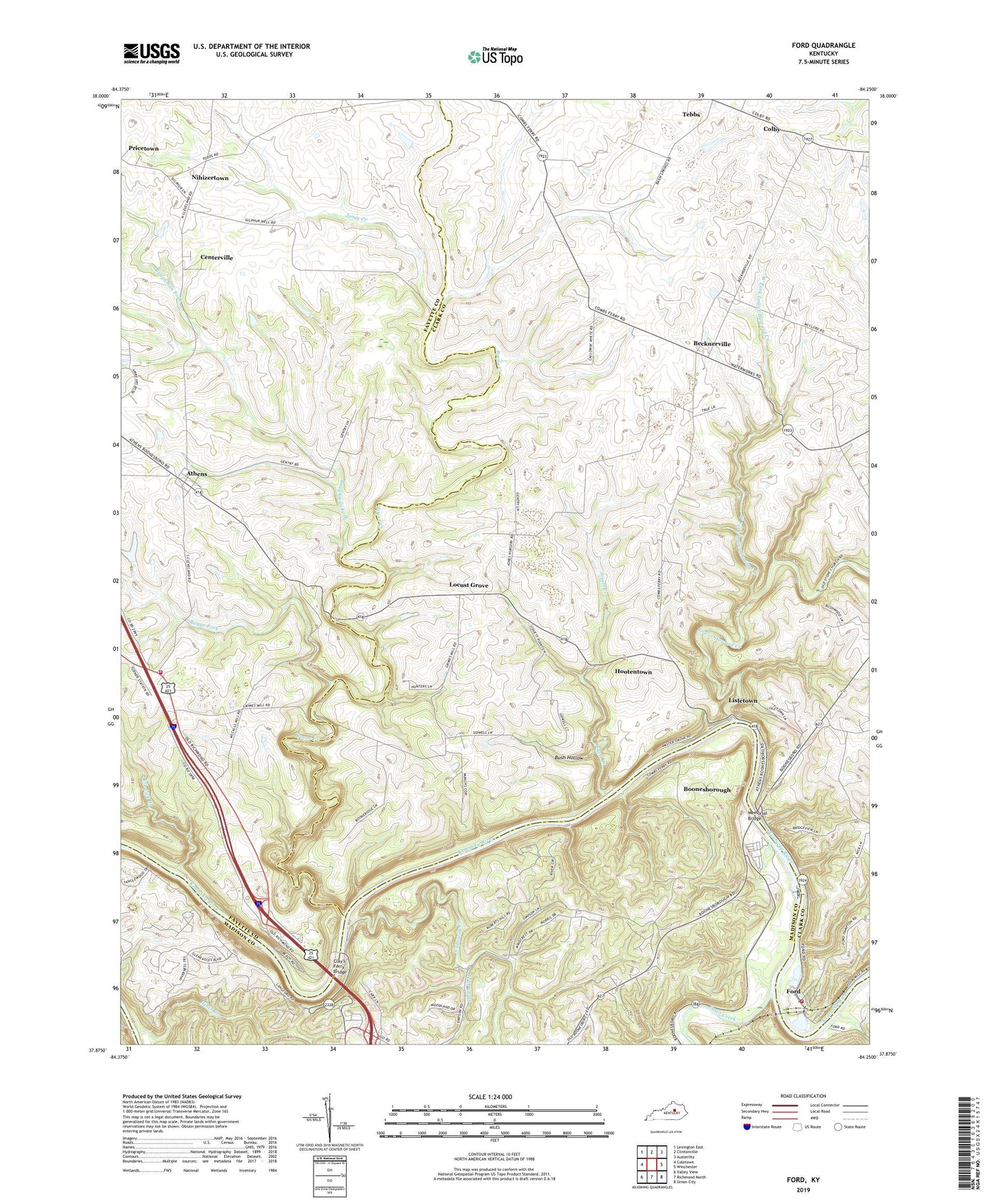
2022 topographic map quadrangle Ford in the state of Kentucky. Scale: 1:24000. Based on the newly updated USGS 7.5' US Topo map series, this map is in the following counties: Clark, Fayette, Madison. The map contains contour data, water features, and other items you are used to seeing on USGS maps, but also has updated roads and other features. This is the next generation of topographic maps. Printed on high-quality waterproof paper with UV fade-resistant inks.
Quads adjacent to this one:
West: Coletown
Northwest: Lexington East
North: Clintonville
Northeast: Austerlitz
East: Winchester
Southeast: Union City
South: Richmond North
Southwest: Valley View
This map covers the same area as the classic USGS quad with code o37084h3.
Contains the following named places: Amster Post Office, Athens, Athens Elementary School, Baughman Fork, Becknerville, Becknerville Post Office, Becknerville School, Blue Grass Camp, Boggs Fork, Boone Creek, Boones Creek Baptist Church, Boones Fork Railroad Station, Boones Station State Historic Site, Boonesboro Post Office, Boonesborough, Boonesborough Pioneer Station, Brook Farm, Bush Hollow, Bush Mill, Bushs Landing, Calloway Creek, Calloways Ferry, Captain John Holder Historical Marker, Cedar Hill Stock Farm, Centerville, Clays Ferry, Clay's Ferry Bridge, Colby, Colby Station, Colbyville Post Office, Colbyville Tavern, Combs Ferry, Dewitt Baptist Church, Durbin Memorial Church, Elk Lick Creek, Fishback Post Office, Ford, Ford Church, Ford Post Office, Ford Volunteer Fire Department, Ford-Boonesborough Division, Fords Ferry, Fort Boonesboro State Park, Fort Boonesborough State Park, Hillsdale Stock Farm, Hines Creek, Holders Boat Yard, Holders Landing, Hootentown, Howard and Bush Warehouse, Iroquios Hunt Club, Jones Creek, Jones Nursery, Jones Nursery Post Office, Jouett Creek, Lexington Fire Department Station 18, Lisletown, Locust Grove, Locust Grove Church, Locust Trotting Park, Lower Howard Creek, Memorial Bridge, Morning Star Heliport, Mount Calvary Missionary Baptist Church, Mount Carmel Christian Church, Mount Tabor Church, Mount Zion Baptist Church, Nihizertown, Otter Creek, Pine Grove Station, Pricetown, Rural Retreat, Sanger Post Office, Shearer Post Office, Shearer Railroad Station, Smith Fork, Stones Ferry, Sunnyside Stock Farm, Taylor Mill, Tebbs, Tebbs Station, The Kentucky River Museum, US Lock Number 10, WEKU-FM (Richmond), West Fork Lower Howard Creek, WKLE-TV (Lexington), Youth Church