MyTopo
Clintonville Kentucky US Topo Map
Couldn't load pickup availability
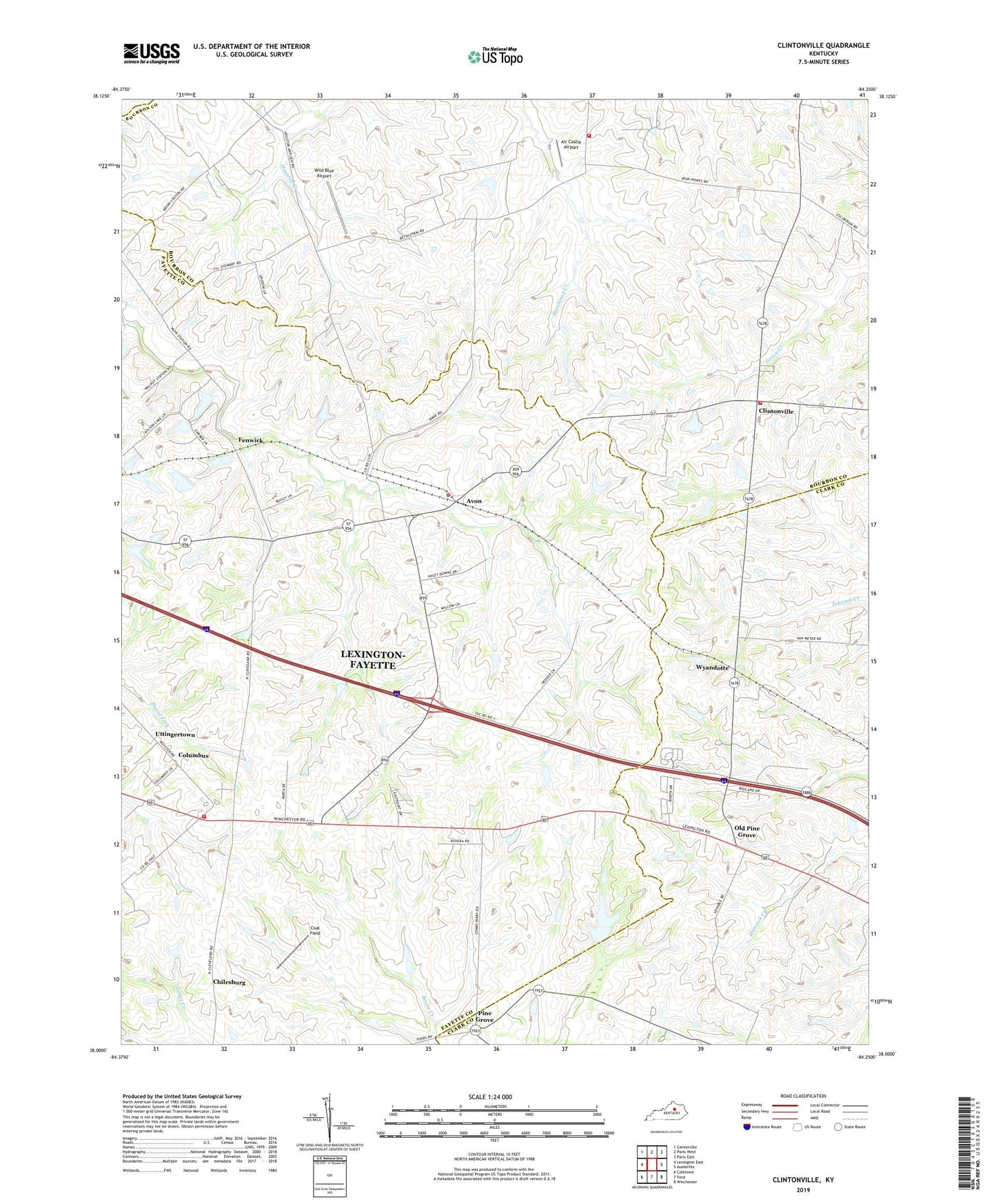
2022 topographic map quadrangle Clintonville in the state of Kentucky. Scale: 1:24000. Based on the newly updated USGS 7.5' US Topo map series, this map is in the following counties: Fayette, Bourbon, Clark. The map contains contour data, water features, and other items you are used to seeing on USGS maps, but also has updated roads and other features. This is the next generation of topographic maps. Printed on high-quality waterproof paper with UV fade-resistant inks.
Quads adjacent to this one:
West: Lexington East
Northwest: Centerville
North: Paris West
Northeast: Paris East
East: Austerlitz
Southeast: Winchester
South: Ford
Southwest: Coletown
This map covers the same area as the classic USGS quad with code o38084a3.
Contains the following named places: Air Castle Airport, Ava Lawn, Avon, Briar Hill School, Chilesburg, Clark County Hemp Historical Marker, Clintonville, Clintonville Volunteer Fire Department, Coal Field, Columbus, Combs Ferry Station, Creech Army Air Field Heliport, David Fork Church, Duvalls Bluff, Ebenezer Methodist Church, Fenwick, Hutchenson Station Volunteer Fire Department, Jasper Post Office, Lexington Fire Department Station 17, Lexington Fire Department Station 23, Lexington-Fayette Northeast Division, Little Zion Church, Locust Lawn, Macedonia Church, Old Pine Grove, Pine Grove, Pine Grove Post Office, Pine Grove Railroad Station, Salem Church, Uttingertown, Van Meter Station, Verna Hills, Wayland Heights Addition, Wild Blue Airport, WLFX-FM (Winchester), Wyandotte, Wyandotte Railroad Station, Yorktown, ZIP Code: 40516