MyTopo
Richmond North Kentucky US Topo Map
Couldn't load pickup availability
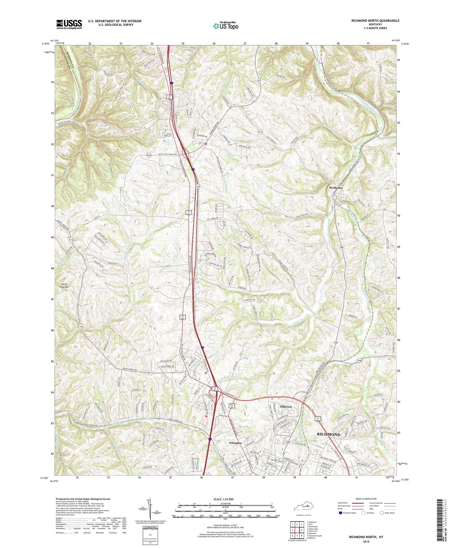
2022 topographic map quadrangle Richmond North in the state of Kentucky. Scale: 1:24000. Based on the newly updated USGS 7.5' US Topo map series, this map is in the following counties: Madison, Fayette. The map contains contour data, water features, and other items you are used to seeing on USGS maps, but also has updated roads and other features. This is the next generation of topographic maps. Printed on high-quality waterproof paper with UV fade-resistant inks.
Quads adjacent to this one:
West: Valley View
Northwest: Coletown
North: Ford
Northeast: Winchester
East: Union City
Southeast: Moberly
South: Richmond South
Southwest: Kirksville
This map covers the same area as the classic USGS quad with code o37084g3.
Contains the following named places: Arlington, Bellevue School, Blue Grass, Blue Grass Post Office, Boonesborough-White Hall Division, Crews Ferry, Daniel Boone School, Dreaming Creek, East Fork Otter Creek, Finney Fork, Greenwood Farm, Hicks Branch, Hillcrest, Irvine Lick, Jacks Creek, Jerry Clay Hill, John Tanner Station, Kit Carson School, Lost Fork, Madison Country Club, Madison County Emergency Medical Services, Madison County Fire Department Station 1, Madison County Regional Fire Training Center, Madison High School, Mount Nebo Church, Mount Nebo School, Mount Pleasant Church, Ophelia Railroad Station, Otter Creek Church, Redhouse, Redhouse Elementary School, Redhouse High School, Redhouse Post Office, Redhouse Railroad Station, Richmond Fire Department Station 4, Rosedale, Stony Run, Sunnyside Farm, Tribble Branch, WCBR-AM (Richmond), West Fork Otter Creek, White Hall, White Hall Post Office, White Hall School, White Hall State Shrine, White Hall Volunteer Fire Department, William Hoys Station, WMCQ-FM (Richmond), ZIP Code: 40475