MyTopo
Valley View Kentucky US Topo Map
Couldn't load pickup availability
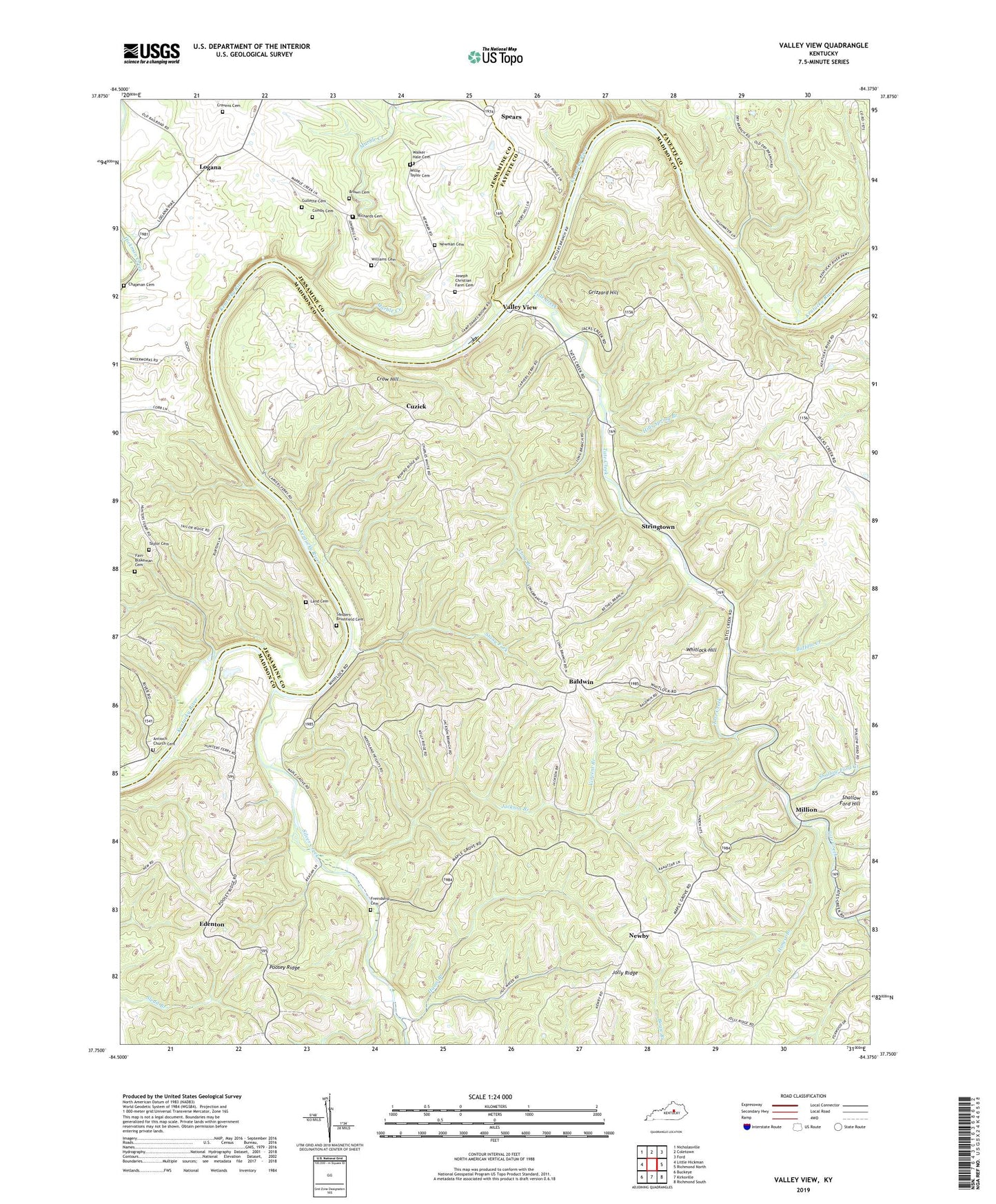
2022 topographic map quadrangle Valley View in the state of Kentucky. Scale: 1:24000. Based on the newly updated USGS 7.5' US Topo map series, this map is in the following counties: Madison, Jessamine, Fayette. The map contains contour data, water features, and other items you are used to seeing on USGS maps, but also has updated roads and other features. This is the next generation of topographic maps. Printed on high-quality waterproof paper with UV fade-resistant inks.
Quads adjacent to this one:
West: Little Hickman
Northwest: Nicholasville
North: Coletown
Northeast: Ford
East: Richmond North
Southeast: Richmond South
South: Kirksville
Southwest: Buckeye
This map covers the same area as the classic USGS quad with code o37084g4.
Contains the following named places: Antioch Church, Antioch Church Cemetery, Baldwin, Baldwin Post Office, Brown Cemetery, Buffalo Creek, Carvers Ferry, Carvers Ferry Post Office, Carvers Landing, Chapman Cemetery, Combs Cemetery, Cottonburg-Valley View Division, Cravens Cemetery, Crow Hill, Crutcher Fork, Cuzick, Cuzick Church, Cuzick Post Office, Delpha Post Office, Distant View Farm, Edenton, Edenton Post Office, Fain-Blakeman Cemetery, Forest Hill Church, Forest Hill School, Freindship Cemetery, Friendship Church, Grapevine School, Grizzard Hill, Gullette Cemetery, Hams Branch, Haysburg Post Office, Hills Spring Branch, Hockaday Post Office, Honest Branch, Hunters Ferry, Idalia Post Office, Jackson Branch, Jolly Ridge, Joseph Christian Farm Cemetery, Land Cemetery, Lock 9, Logana, Logana Post Office, Logana Railroad Station, Long Branch, Lower Hunters Ferry, Marble Creek, Miller School, Million, Million Post Office, Millions Saw Mill, Mount Eden Christian Church, Mount Eden Church, Newby, Newby Church, Newby Post Office, Newby School, Newman Cemetery, Old Dominion Farm, Perkins Post Office, Poosey Ridge, Richards Cemetery, Riverview Church, Sanders-Brumfield Cemetery, Shallow Ford Creek, Shallow Ford Hill, Silver Creek, Spears, Spears Elementary School, Spears Post Office, Stony Fork, Stringtown, Sycamore Grove Farm, Tate Creek, Taylor Cemetery, Taylors Chapel, Trinity Church, Valley View, Valley View Ferry, Vincent Branch, Walker - Hale Cemetery, Whitlock Hill, Whitlock Post Office, Whitlock Railroad Station, Williams Cemetery, Willie Taylor Cemetery, Woodland Heights Church, YMCA Boone Camp