MyTopo
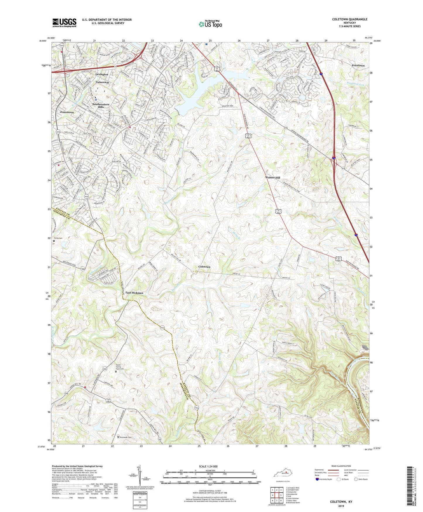
Coletown Kentucky US Topo Map
Couldn't load pickup availability
2022 topographic map quadrangle Coletown in the state of Kentucky. Scale: 1:24000. Based on the newly updated USGS 7.5' US Topo map series, this map is in the following counties: Fayette, Jessamine, Madison. The map contains contour data, water features, and other items you are used to seeing on USGS maps, but also has updated roads and other features. This is the next generation of topographic maps. Printed on high-quality waterproof paper with UV fade-resistant inks.
Quads adjacent to this one:
West: Nicholasville
Northwest: Lexington West
North: Lexington East
Northeast: Clintonville
East: Ford
Southeast: Richmond North
South: Valley View
Southwest: Little Hickman
This map covers the same area as the classic USGS quad with code o37084h4.
Contains the following named places: Bluegrass Baptist Church, Bronaugh Cemetery, Chapel Hill Presbyterian Church, Coletown, Crossroads Christian Church, David R Atchison Historical Marker, East Hickman, East Hickman Baptist Church, East Hickman Creek, Edythe J Hayes Middle School, Evergreen Farm, Family Worship Center, First United Methodist Church-Andover Activity Center, Gainesway, Jessamine County Fire Department Station 2, Jonestown, Julius Marks Elementary School, Lexington, Lexington Baptist Temple, Lexington Bethel Baptist Church, Lexington Division of Police - East Sector, Lexington Fire Department Station 16, Lexington Fire Department Station 22, Lexington Fire Department Station 7, Lexington Public Library-Eagle Creek Branch, Lexington Public Library-Tates Creek Branch, Lexington Reservoir Number 4, Lexington-Fayette Southeast Division, Lilac Bower Farm, Man-O-War Church of God, Marble Creek Baptist Church, Millcreek Elementary School, Mount Gilead Baptist Church, New Apostolic Church, Raven Run, Richmond Road Baptist Church, Saint Joseph Hospital East, Saint Luke United Methodist Church, Shelby Branch, Shelby School, Southeastern Hills, Squires Elementary School, Tates Creek Country Club, Tates Creek Elementary School, Tates Creek High School, Tates Creek Middle School, Tatesbrook Baptist Church, Taylor Family Farm Cemetery, The Church of Jesus Christ of Latter-day Saints, Todds Road Grace Church, Trinity Christian Academy, Trinity Hill United Methodist Church, Victory Baptist Church, Walnut Hill, Walnut Hill Presbyterian Church, Walnut Hill Presbyterian Church Historical Marker, West Hickman Creek, Word of Hope Lutheran Church, Young Cemetery, ZIP Codes: 40509, 40515, 40517