MyTopo
Red Boiling Springs Tennessee US Topo Map
Couldn't load pickup availability
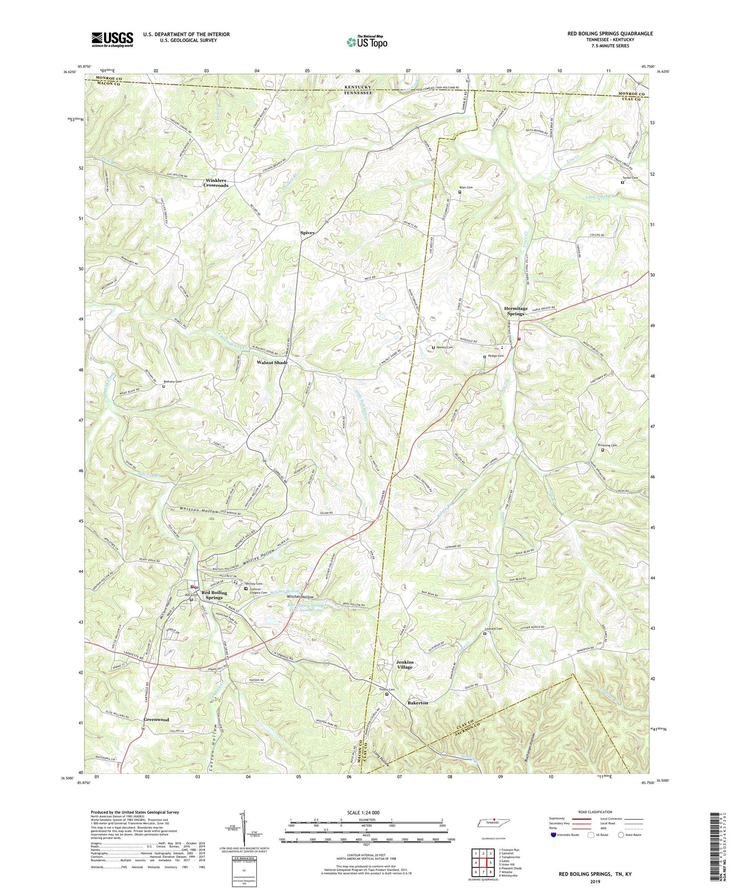
2022 topographic map quadrangle Red Boiling Springs in the state of Tennessee. Scale: 1:24000. Based on the newly updated USGS 7.5' US Topo map series, this map is in the following counties: Macon, Clay, Jackson, Monroe. The map contains contour data, water features, and other items you are used to seeing on USGS maps, but also has updated roads and other features. This is the next generation of topographic maps. Printed on high-quality waterproof paper with UV fade-resistant inks.
Quads adjacent to this one:
West: Galen
Northwest: Fountain Run
North: Gamaliel
Northeast: Tompkinsville
East: Union Hill
Southeast: Whitleyville
South: Willette
Southwest: Pleasant Shade
This map covers the same area as the classic USGS quad with code o36085e7.
Contains the following named places: Bakerton, Bakerton Church of Christ, Bean Branch, Bell Cemetery, Bethany Cemetery, Bethany Church, Biles Cemetery, Browning Cemetery, Capshaw Mill, Chicken Branch, City of Red Boiling Springs, Commissioner District 1, Commissioner District 12, Cothron - Gregory Cemetery, Cotton Hollow, Greenwood, Greenwood School, Hermitage Springs, Hermitage Springs Church of Christ, Hermitage Springs High School, Hermitage Springs Volunteer Fire and Rescue, Jenkins Village, Leonard, Leonard Cemetery, Leonard Church, Leonard School, Little Creek Farms, Little Salt Lick Creek, Little Trace Creek, Long Hungry Creek, Macedonia Church, McClure Hollow, Pedigo Cemetery, Red Boiling Springs, Red Boiling Springs City Hall, Red Boiling Springs Dam Number One, Red Boiling Springs Division, Red Boiling Springs Fire Department, Red Boiling Springs First Baptist Church, Red Boiling Springs Lake Number One, Red Boiling Springs Police Department, Red Boiling Springs Post Office, Red Boiling Springs School, Red Boiling Springs Watershed Lake Number Two, Red Boiling Springs Watershed Number Two Dam, Reeves Cemetery, Sadlers Chapel, Smith Chapel, Spivey, Trace Creek, Turner Cemetery, Vinson Cemetery, Walnut Grove Church, Walnut Shade, Whitley Cemetery, Whitley Hollow, Whitson Hollow, Wilson Branch, Winklers Crossroads, Witcher Hollow, Witcher Hollow Branch, ZIP Code: 37150