MyTopo
Glasgow North Kentucky US Topo Map
Couldn't load pickup availability
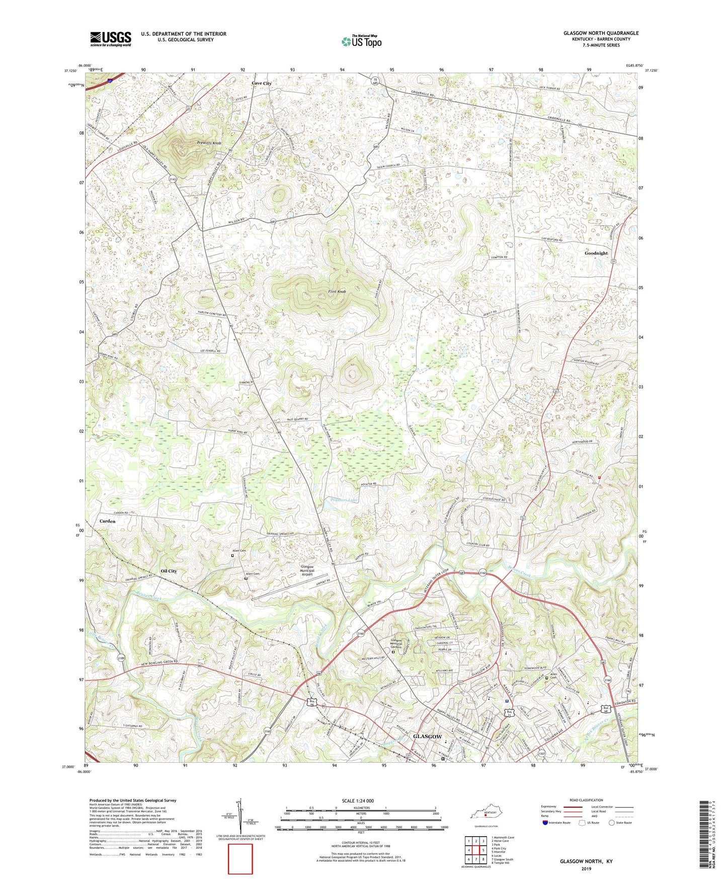
2022 topographic map quadrangle Glasgow North in the state of Kentucky. Scale: 1:24000. Based on the newly updated USGS 7.5' US Topo map series, this map is in the following counties: Barren. The map contains contour data, water features, and other items you are used to seeing on USGS maps, but also has updated roads and other features. This is the next generation of topographic maps. Printed on high-quality waterproof paper with UV fade-resistant inks.
Quads adjacent to this one:
West: Park City
Northwest: Mammoth Cave
North: Horse Cave
Northeast: Park
East: Hiseville
Southeast: Temple Hill
South: Glasgow South
Southwest: Lucas
This map covers the same area as the classic USGS quad with code o37085a8.
Contains the following named places: Allen - Church - Steffey Cemetery, Allen Cemetery, Allen Cemetery Number 4, Basil Chapel, Brotherhood Church, Browders Chapel, Carden, Cave City Division, City of Glasgow, Flint Knob, Fort Williams Historical Marker, Glasgow Country Club, Glasgow Municipal Airport, Glenview Church, Goodnight, Happy Valley Memorial Gardens, Happy Valley School, Harlow Chapel, Hiseville Volunteer Fire Department Station 2, Little Beaver Creek, Little Bethel Church, Long Hunters Camp Historical Marker, Mount Tabor Church, Oil City, Poynters Lake, Prewitts Knob, Salem Church, Terry School, TJ Samson Community Hospital, WCLU-AM (Glasgow), WHHT-FM (Cave City), WSMJ-AM (Cave City), ZIP Code: 42127