MyTopo
Mammoth Cave Kentucky US Topo Map
Couldn't load pickup availability
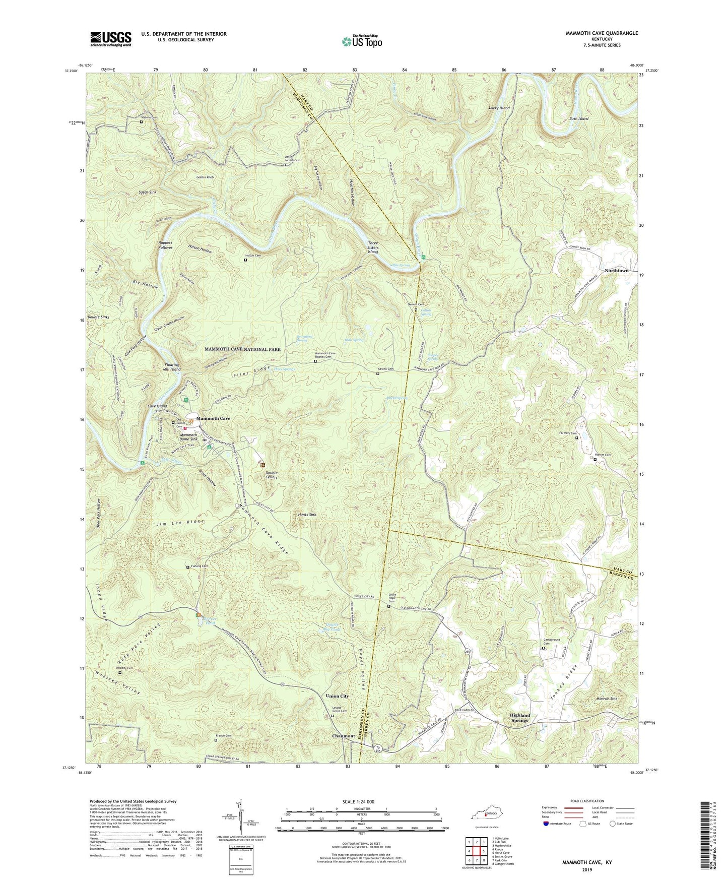
2022 topographic map quadrangle Mammoth Cave in the state of Kentucky. Scale: 1:24000. Based on the newly updated USGS 7.5' US Topo map series, this map is in the following counties: Edmonson, Hart, Barren. The map contains contour data, water features, and other items you are used to seeing on USGS maps, but also has updated roads and other features. This is the next generation of topographic maps. Printed on high-quality waterproof paper with UV fade-resistant inks.
Quads adjacent to this one:
West: Rhoda
Northwest: Nolin Lake
North: Cub Run
Northeast: Munfordville
East: Horse Cave
Southeast: Glasgow North
South: Park City
Southwest: Smiths Grove
This map covers the same area as the classic USGS quad with code o37086b1.
Contains the following named places: Adwell Cemetery, Adwell Pumphouse, Adwell Spring, Beaver Pond, Big Hollow, Big Spring Hollow, Big Woods, Blair Spring, Bransford Pumphouse, Bransford Spring, Bruce Hollow, Bush Island, Camp Ground Cemetery, Cave Island, Chaumont, Collins Spring, Cooper Spring, Cow Ford Hollow, Daniels Cemetery, Deer Park Hollow, Dennison Ferry, Double Cellars, Double Sinks, Doyel Valley, Doyels Big Pond, Dry Run, Eaton Valley, Echo River, Echo River Spring Trail, Farmers Cemetery, Flint Ridge, Flint Ridge Ranger Station, Floating Mill Hollow, Floating Mill Island, France Cemetery, Freedom Church, Furlong Cemetery, Goblin Knob, Great Onyx Cave Pumphouse, Great Onyx Job Corps Center, Green River Bluffs Trail, Hamilton Valley, Highland Springs, Holton Cemetery, Holton Hollow, Houchin Hollow, Houchins Valley, Hunter Cemetery, Hunts Sink, Jim Lee Ridge, Joppa Ridge, Katy Pace Valley, Little Hope Cemetery, Little Hope Church, Little Jordan Cemetery, Locust Grove Cemetery, Lucky Island, Mammoth Cave, Mammoth Cave Baptist Church, Mammoth Cave Cemetery, Mammoth Cave Post Office, Mammoth Cave Ridge, Mammoth Cave Volunteer Fire Department, Mammoth Dome Sink, Monroe Sink, Mount McKinley Pumphouse, Nappers Rollover, Northtown, Old Guide's Cemetery, Owens Valley, Pike Spring, Piney Creek, Rigdon Hollow, River Styx, Sand Cave Historical Marker, Sank Hollow, Sloans Crossing, Strawberry Valley, Sugar Sink, Taylor Coates Hollow, Three Sisters Hollow, Three Sisters Island, Three Springs, Three Springs Pumphouse, Tom Johns Crossing, Toohey Ridge, Ugly Creek, Union City, Wilkins Cemetery, Wilson Cave Hollow, Woolsey Cemetery