
MyTopo
Howardstown Kentucky US Topo Map
Couldn't load pickup availability
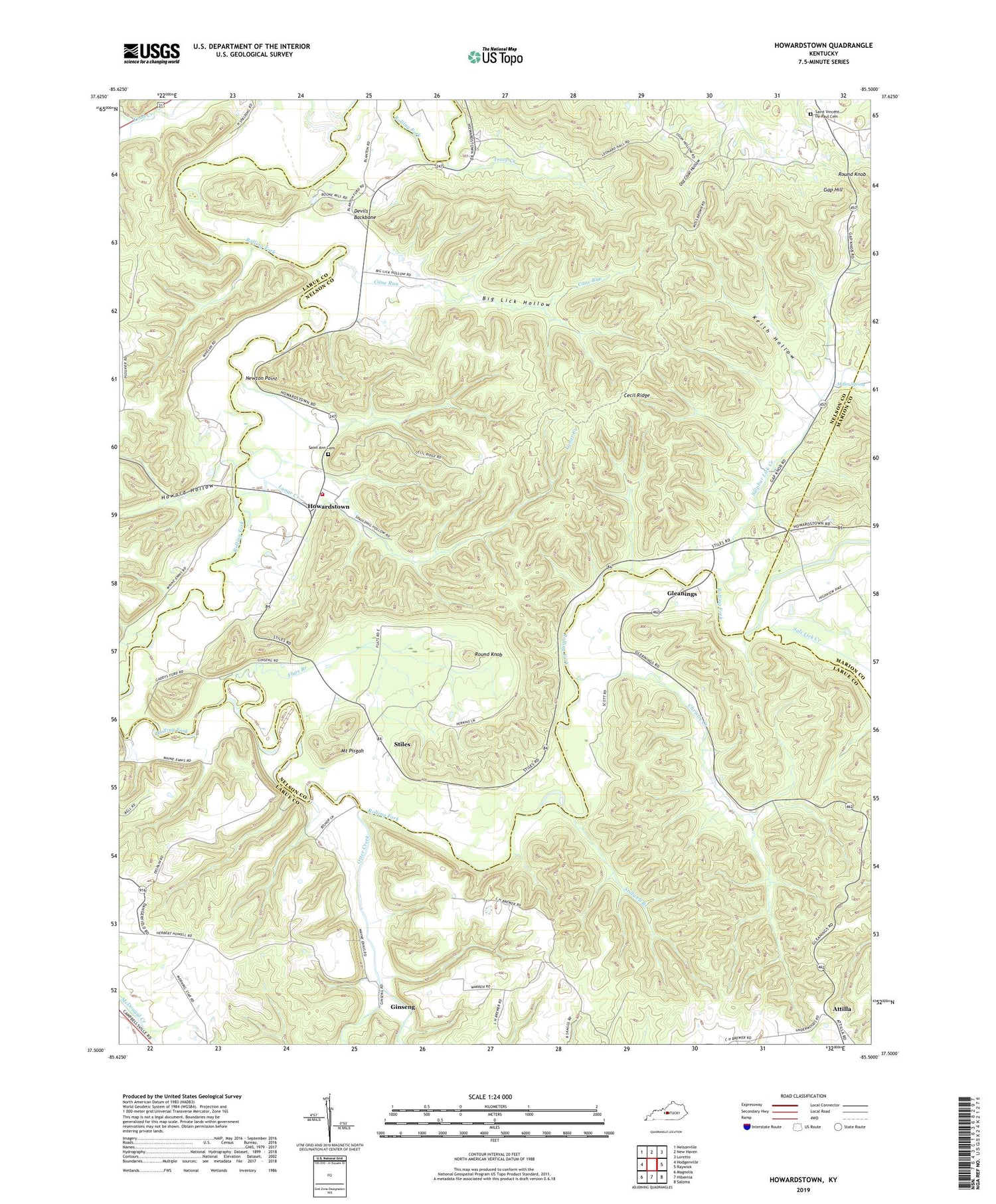
2022 topographic map quadrangle Howardstown in the state of Kentucky. Scale: 1:24000. Based on the newly updated USGS 7.5' US Topo map series, this map is in the following counties: Nelson, Larue, Marion. The map contains contour data, water features, and other items you are used to seeing on USGS maps, but also has updated roads and other features. This is the next generation of topographic maps. Printed on high-quality waterproof paper with UV fade-resistant inks.
Quads adjacent to this one:
West: Hodgenville
Northwest: Nelsonville
North: New Haven
Northeast: Loretto
East: Raywick
Southeast: Saloma
South: Hibernia
Southwest: Magnolia
This map covers the same area as the classic USGS quad with code o37085e5.
Contains the following named places: Attilla, Attilla Post Office, Beech Grove Church, Bethel Church, Big Lick Hollow, Brays Ford, Buffalo Division, Cane Run, Cecil Ridge, Christie Creek, Devils Backbone, Flats Branch, Gap Hill, Ginseng, Ginseng Post Office, Gleanings, Gleanings Post Office, Highview, Howard Hollow, Howardstown, Keith Hollow, Levelwood Church, Levelwood School, Lunar Creek, McGee and Boone Ford, Miller Spring, Mobley Post Office, Mount Pisgah, Newton Point, Old Coon Hollow, Old Ford, Otter Creek, Rolling Fork Baptist Church, Rolling Fork Fire Department Substation, Round Knob, Saint Ann Cemetery, Saint Vincent De Paul Cemetery, Salt Lick Creek, Salt Lick Post Office, School Number Nine, Stiles, Stillwell Branch, Sulphur Lick Creek, Thompson Creek, Trace Creek, West Fork Otter Creek


