MyTopo
Raywick Kentucky US Topo Map
Couldn't load pickup availability
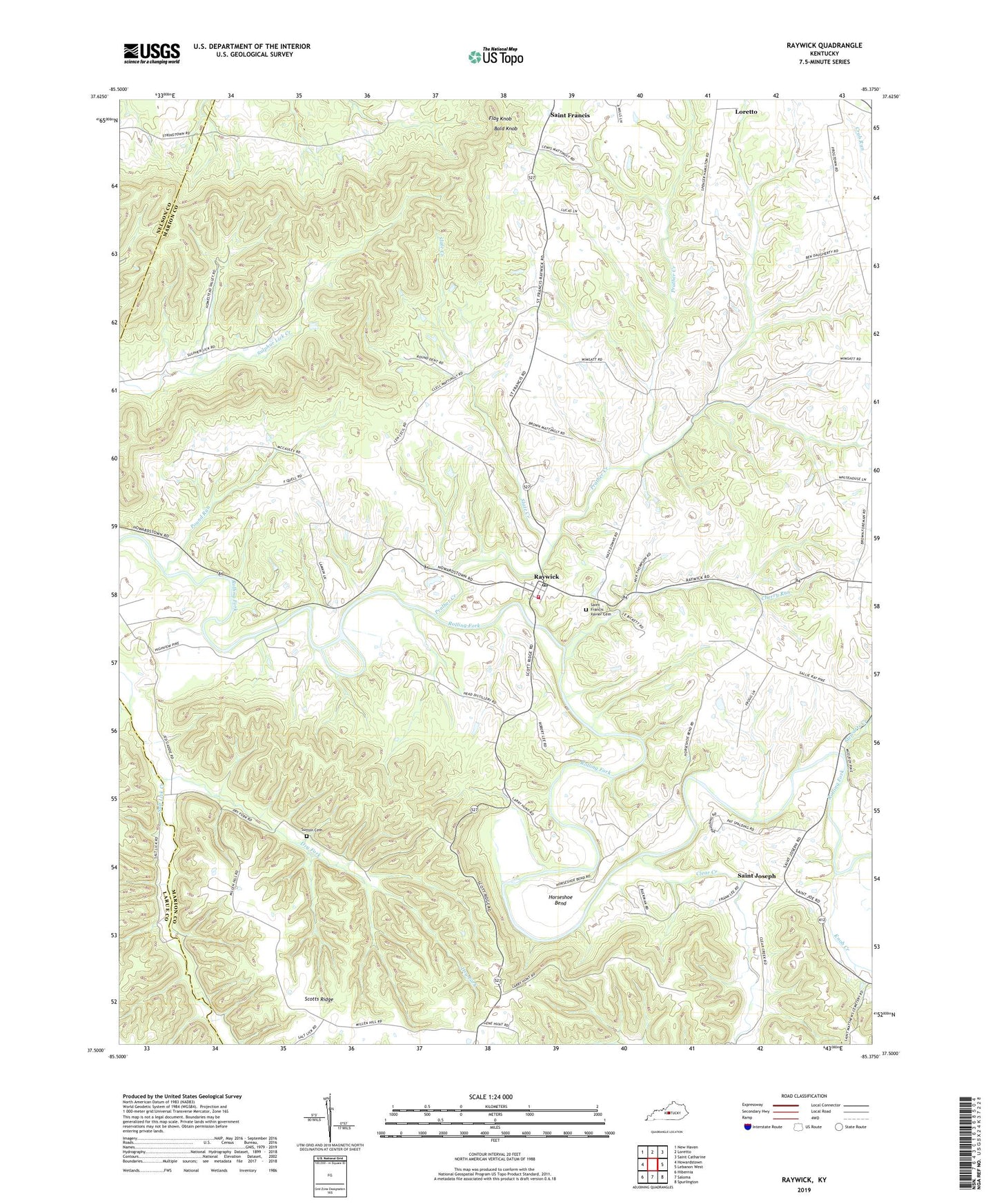
2022 topographic map quadrangle Raywick in the state of Kentucky. Scale: 1:24000. Based on the newly updated USGS 7.5' US Topo map series, this map is in the following counties: Marion, Larue, Nelson. The map contains contour data, water features, and other items you are used to seeing on USGS maps, but also has updated roads and other features. This is the next generation of topographic maps. Printed on high-quality waterproof paper with UV fade-resistant inks.
Quads adjacent to this one:
West: Howardstown
Northwest: New Haven
North: Loretto
Northeast: Saint Catharine
East: Lebanon West
Southeast: Spurlington
South: Saloma
Southwest: Hibernia
This map covers the same area as the classic USGS quad with code o37085e4.
Contains the following named places: Bald Knob, Cherry Run, City of Raywick, Clear Creek, Downs, Dry Fork, Flag Knob, Harcourt Post Office, Highview School, Horseshoe Bend, Knob Creek, McCauley, Mount Washington School, Pound Run, Prather Creek, Raywick, Raywick Division, Raywick Elementary School, Raywick Fire Department, Raywick Historical Marker, Raywick Post Office, Saint Francis Xavier Cemetery, Saint Francis Xavier Church, Saint Joseph, Saint Joseph Church, Saint Joseph School, Scotts Ridge, Slate Creek, Stewarts Creek, Sulpher Lick Creek, Sutton Cemetery, ZIP Codes: 40052, 40060, 40062