MyTopo
Hickory Kentucky US Topo Map
Couldn't load pickup availability
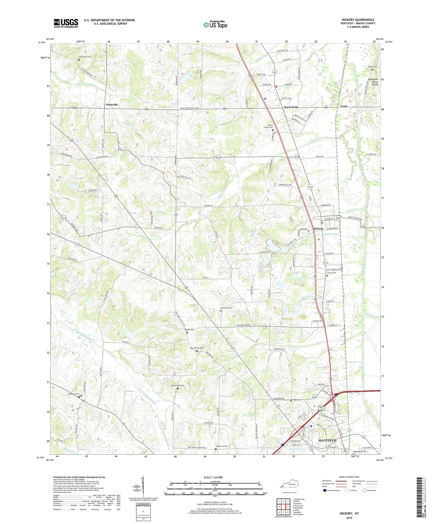
2022 topographic map quadrangle Hickory in the state of Kentucky. Scale: 1:24000. Based on the newly updated USGS 7.5' US Topo map series, this map is in the following counties: Graves. The map contains contour data, water features, and other items you are used to seeing on USGS maps, but also has updated roads and other features. This is the next generation of topographic maps. Printed on high-quality waterproof paper with UV fade-resistant inks.
Quads adjacent to this one:
West: Fancy Farm
Northwest: Lovelaceville
North: Melber
Northeast: Symsonia
East: Westplains
Southeast: Farmington
South: Mayfield
Southwest: Dublin
This map covers the same area as the classic USGS quad with code o36088g6.
Contains the following named places: Anderson Creek, Byrd Creek, Chalk Branch, Cooley Creek, County War Memorial Fairgrounds, Crowley Branch, Dowdy Cemetery, Dunn Cemetery, Gilbert Creek, Hickory, Hickory Census Designated Place, Hickory Post Office, Hickory-Lowes Division, Jackson Purchase Medical Center, Kentucky State Police Post 1, Key Creek, Maplewood Cemetery, Moore Family Cemetery, New Dowdy Cemetery, New Hope Church, New Zion Cemetery, New Zion Church, Oak Grove Cemetery, Oak Grove Church, Oak Grove Creek, Old Dowdy Cemetery, Old Union Cemetery, Pleasant Grove Church, Pottsville, Salem Cemetery, Trinity Cemetery, Trinity Church, Viola, Viola Fire Station, West Viola, WNGO-AM (Mayfield), Wrights Cemetery, Wright's Cemetery, WXID-FM (Mayfield), WYMC-AM (Mayfield), ZIP Code: 42051