MyTopo
Melber Kentucky US Topo Map
Couldn't load pickup availability
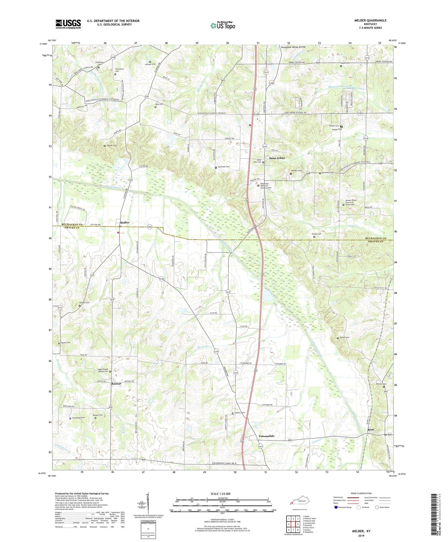
2022 topographic map quadrangle Melber in the state of Kentucky. Scale: 1:24000. Based on the newly updated USGS 7.5' US Topo map series, this map is in the following counties: Graves, McCracken. The map contains contour data, water features, and other items you are used to seeing on USGS maps, but also has updated roads and other features. This is the next generation of topographic maps. Printed on high-quality waterproof paper with UV fade-resistant inks.
Quads adjacent to this one:
West: Lovelaceville
Northwest: Heath
North: Paducah West
Northeast: Paducah East
East: Symsonia
Southeast: Westplains
South: Hickory
Southwest: Fancy Farm
This map covers the same area as the classic USGS quad with code o36088h6.
Contains the following named places: Allcock Cemetery, Armistead Cemetery, Boaz, Boaz Post Office, Carney Creek, Diggs Chapel, Diggs Chapel - Kansas Cemetery, Dunaway Cemetery, Folsomdale, Harper Cemetery, Haynes Cemetery, Heard Cemetery, Houser Cemetery, Houser Grove Church, Houser Grove Church of Christ Cemetery, Hunt Cemetery, Johnson Cemetery, Jones Cemetery, Kansas, Kauffman, Liberty Cemetery, Liberty Church, McNeil Cemetery, Melber, Melber Fire Station, Melber Post Office, Morris Creek, New Hope Church, Oak Grove, Purchase Cemetery, Russell Cemetery, Saint John Cemetery, Saint Johns, Salem Church, Straub Cemetery, Thompson Cemetery, Tittsworth Cemetery, Wice Church, WKPD-TV (Paducah), Woodlawn Memorial Gardens Cemetery, Wurth, Yopp, ZIP Code: 42027