MyTopo
Mayfield Kentucky US Topo Map
Couldn't load pickup availability
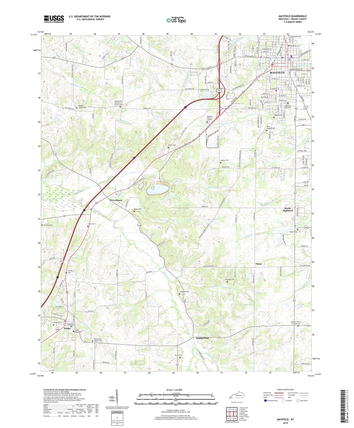
2022 topographic map quadrangle Mayfield in the state of Kentucky. Scale: 1:24000. Based on the newly updated USGS 7.5' US Topo map series, this map is in the following counties: Graves. The map contains contour data, water features, and other items you are used to seeing on USGS maps, but also has updated roads and other features. This is the next generation of topographic maps. Printed on high-quality waterproof paper with UV fade-resistant inks.
Quads adjacent to this one:
West: Dublin
Northwest: Fancy Farm
North: Hickory
Northeast: Westplains
East: Farmington
Southeast: Lynnville
South: Cuba
Southwest: Water Valley
This map covers the same area as the classic USGS quad with code o36088f6.
Contains the following named places: Alexander Cemetery, Allison Cemetery, Anderson Cemetery, Bethel Cemetery, Calvary Cemetery, Calvary Church, Chaney Cemetery, City of Mayfield, City of Wingo, Copeland Cemetery, Dodson Cemetery, Douthitt Creek, Enon Church, Fellowship Baptist Cemetery, Graves County, Graves County Sheriff's Office, Highland Park Cemetery, Jones Cemetery, Kentucky Division of Forestry Western District, Lebanon Church, Lebanon Church of Christ Cemetery, Lee School, Little Cypress Creek, Longfellow School, Macedonia Church, Macedonia Church of Christ Cemetery, Mayfield, Mayfield - Graves County Ambulance Service, Mayfield Division, Mayfield Fire and Rescue Station, Mayfield Fire Department Station, Mayfield Fire Department Station 1, Mayfield Fire Department Station 2, Mayfield Memory Garden, Mayfield Police Department, Mayfield Post Office, New Liberty Church, Opossum Creek, Payne, Powers Creek, Pryorsburg, Pryorsburg Census Designated Place, Richard Creek, Robbins Cemetery, Rozzell Chapel Cemetery, Rozzell Church, Saint James Church, Saint Josephs Cemetery, Saint Josephs School, Saint Paul Cemetery, Saxon Cemetery, Scroggins Ditch, Shady Grove Church, Sharon Baptist Church, Sharon Cemetery, Shotgun Lake, South Highland, Straight Church, Stubblefield, Sunset Lake, Travis Branch, Washington School, Wingo, Wingo Cemetery, Wingo Fire Department, Wingo Post Office, ZIP Code: 42066