MyTopo
Lovelaceville Kentucky US Topo Map
Couldn't load pickup availability
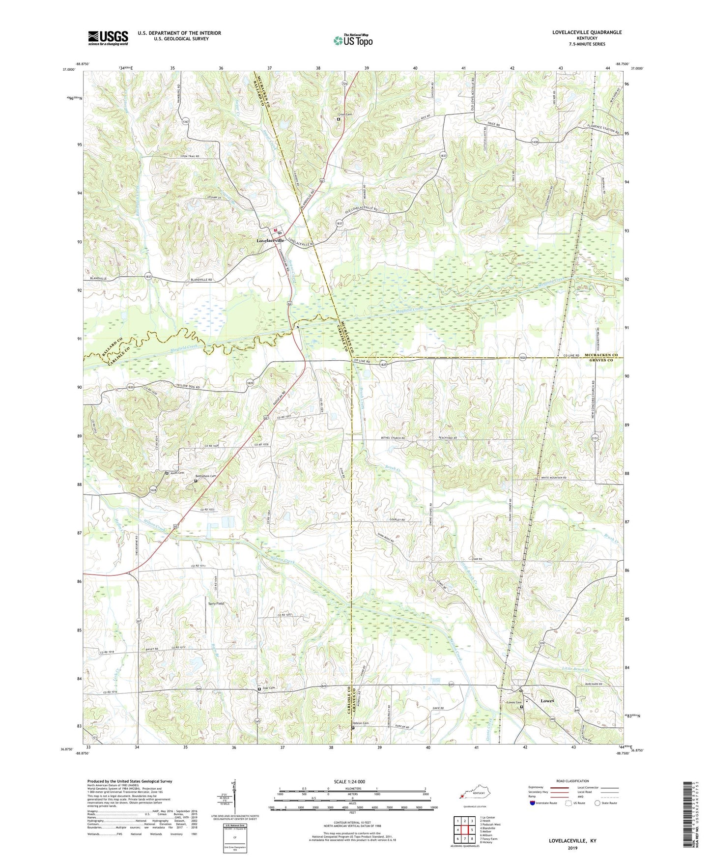
2022 topographic map quadrangle Lovelaceville in the state of Kentucky. Scale: 1:24000. Based on the newly updated USGS 7.5' US Topo map series, this map is in the following counties: Graves, Carlisle, McCracken, Ballard. The map contains contour data, water features, and other items you are used to seeing on USGS maps, but also has updated roads and other features. This is the next generation of topographic maps. Printed on high-quality waterproof paper with UV fade-resistant inks.
Quads adjacent to this one:
West: Blandville
Northwest: La Center
North: Heath
Northeast: Paducah West
East: Melber
Southeast: Hickory
South: Fancy Farm
Southwest: Milburn
This map covers the same area as the classic USGS quad with code o36088h7.
Contains the following named places: Barn Branch, Bethel Church, Bethlehem Cemetery, Billington Creek, Brush Creek, California Hills, Camelia Division, Cross Cemetery, Fort Holt, Glissonville, Goose Creek, Granite Branch, Hebron Cemetery, Heflin Creek, Jones Cemetery, Lick Creek, Little Brush Creek, Lovelaceville, Lovelaceville Census Designated Place, Lovelaceville Fire Department, Lovelaceville Post Office, Lowes, Lowes Cemetery, Lowes Census Designated Place, Lowes Post Office, New Concord Church, Owens Chapel, Palestine Methodist Church, Scotts Corner, Shaw, Sugar Creek, Terry Field, Wilson, Yellow Dog Road, Zoar, Zoar Baptist Church, Zoar Cemetery, ZIP Codes: 42035, 42060, 42061, 42069