MyTopo
Hustonville Kentucky US Topo Map
Couldn't load pickup availability
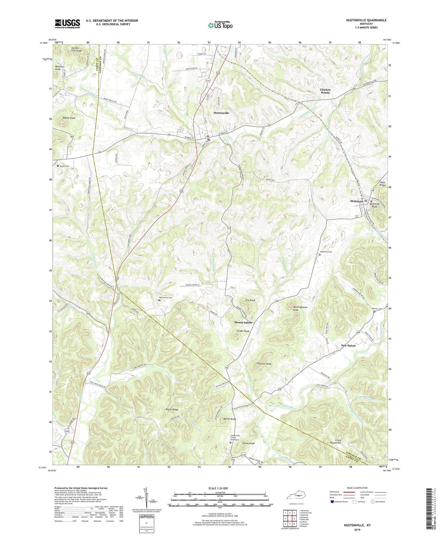
2022 topographic map quadrangle Hustonville in the state of Kentucky. Scale: 1:24000. Based on the newly updated USGS 7.5' US Topo map series, this map is in the following counties: Lincoln, Casey. The map contains contour data, water features, and other items you are used to seeing on USGS maps, but also has updated roads and other features. This is the next generation of topographic maps. Printed on high-quality waterproof paper with UV fade-resistant inks.
Quads adjacent to this one:
West: Ellisburg
Northwest: Parksville
North: Junction City
Northeast: Stanford
East: Halls Gap
Southeast: Eubank
South: Yosemite
Southwest: Liberty
This map covers the same area as the classic USGS quad with code o37084d7.
Contains the following named places: Baughman Creek, Big Moccasin Creek, Brown Cemetery, Buzzard Knob, Carpenter Creek, Chicken Bristle, City of Hustonville, Cloyd - Hicks Family Graveyard, Cow Creek, Dry Knob, Fletcher Knob, Frey Creek, George Branch, Gordon Lick Knob, Grider Knob, Hickory Hills Country Club, Hustonville, Hustonville Division, Hustonville Fire Department, Hustonville Police Department, Hustonville Post Office, Indian Creek, Indian Creek School, Kidds Store, Kidds Store Post Office, Kidds Store School, Little Moccasin Creek, Little Round Hill, Long Branch, Martin Knob, Maxey Knob, Maxey Valley Church of God, Maxey Valley School, McCormick Cemetery, McKinney, McKinney Area Rescue Squad, McKinney Bluff, McKinney Branch, McKinney Cemetery, McKinney Census Designated Place, McKinney Post Office, Meetinghouse Knob, Moccasin School, Mount Salem, New Salem, Patsy Riffe School, Peltis Fork, Pine Lick Church, Pine Lick Creek, Richards School, Riffle Ridge, Ruletown, South Fork Green River, Spears Creek, Stapp, Stapp School, Turkey Knob, Turkey Knob School, Wilcher Cemetery, Yates Ridge, ZIP Codes: 40437, 40448