MyTopo
Means Kentucky US Topo Map
Couldn't load pickup availability
Also explore the Means Forest Service Topo of this same quad for updated USFS data
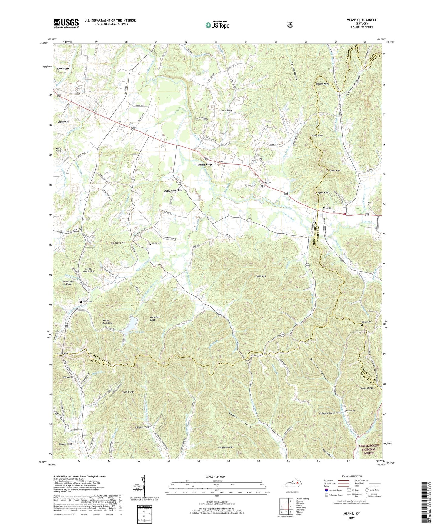
2022 topographic map quadrangle Means in the state of Kentucky. Scale: 1:24000. Based on the newly updated USGS 7.5' US Topo map series, this map is in the following counties: Montgomery, Powell, Menifee, Bath. The map contains contour data, water features, and other items you are used to seeing on USGS maps, but also has updated roads and other features. This is the next generation of topographic maps. Printed on high-quality waterproof paper with UV fade-resistant inks.
Quads adjacent to this one:
West: Levee
Northwest: Mount Sterling
North: Preston
Northeast: Olympia
East: Frenchburg
Southeast: Slade
South: Stanton
Southwest: Clay City
This map covers the same area as the classic USGS quad with code o37083h7.
Contains the following named places: Anders Branch, Barnett Branch, Bean Post Office, Big Round Mountain, Bird Branch, Boone Post Office, Bowen Ridge, C. F. Strance Mill, Camp Branch, Cane Creek Gap Church, Cash Knob Post Office, Cave Branch, Cedar Grove Post Office, Cedar Grove Railroad Station, Cedar Knob, Chambers Railroad Station, Chimney Rocks, City of Jeffersonville, Clay Lick Branch, Clay Lick Railroad Station, Congleton Mountain, Cooks Branch, Cooks Branch Slate, Dogtrot Branch, Double Gate Hunt Club, East Fork Slate Creek, Easter Church, Ficklin Fork, Gibson Hollow, Gibson Knob, Gillum Cemetery, Hawkins Branch, Hedger Hollow, Hickory Knob, Horselick Knob, Jeffersonville, Jeffersonville Division, Jeffersonville Post Office, Johnson Knob, Judy, Kashs Knob, Little Ella Church, Little Round Mountain, Long Branch, Lovely Cemetery, Lower Spruce Creek, Lucky Stop, Martin Cemetery, Martin Fork, Means, Means Fire Department, Means Post Office, Middle Fork Right Fork Cane Creek, Miller Cemetery, Morris Creek, Morris Creek School, Mountaview Post Office, Myers Cemetery, Napier Hollow, Old Salem Church, Persimmon Ridge, Pine Hill Church, Pine Hill School, Plum Tree Branch, Popular Mountain, Pottersville Hollow, Rebelsville, Rocky Branch, Rocky Branch Church, Safferty Branch, Salem, Sand Mountain, Science Ridge, Sid Calk Lake, Slate Creek Church, South Fork Upper Spruce Creek, Spruce Church, Spruce Creek, Spruce School, Stevens Knob, Travelers Rest, Turkey Knob, Upper Spruce Creek, Wagon Bed Knob, WBFC-AM (Stanton), West Fork Slate Creek, Wildcat Mountain, Willoughby Fork, Willoughby Nation, Willoughby School, Wills Cemetery, Wills School, ZIP Code: 40337