MyTopo
Marion Kentucky US Topo Map
Couldn't load pickup availability
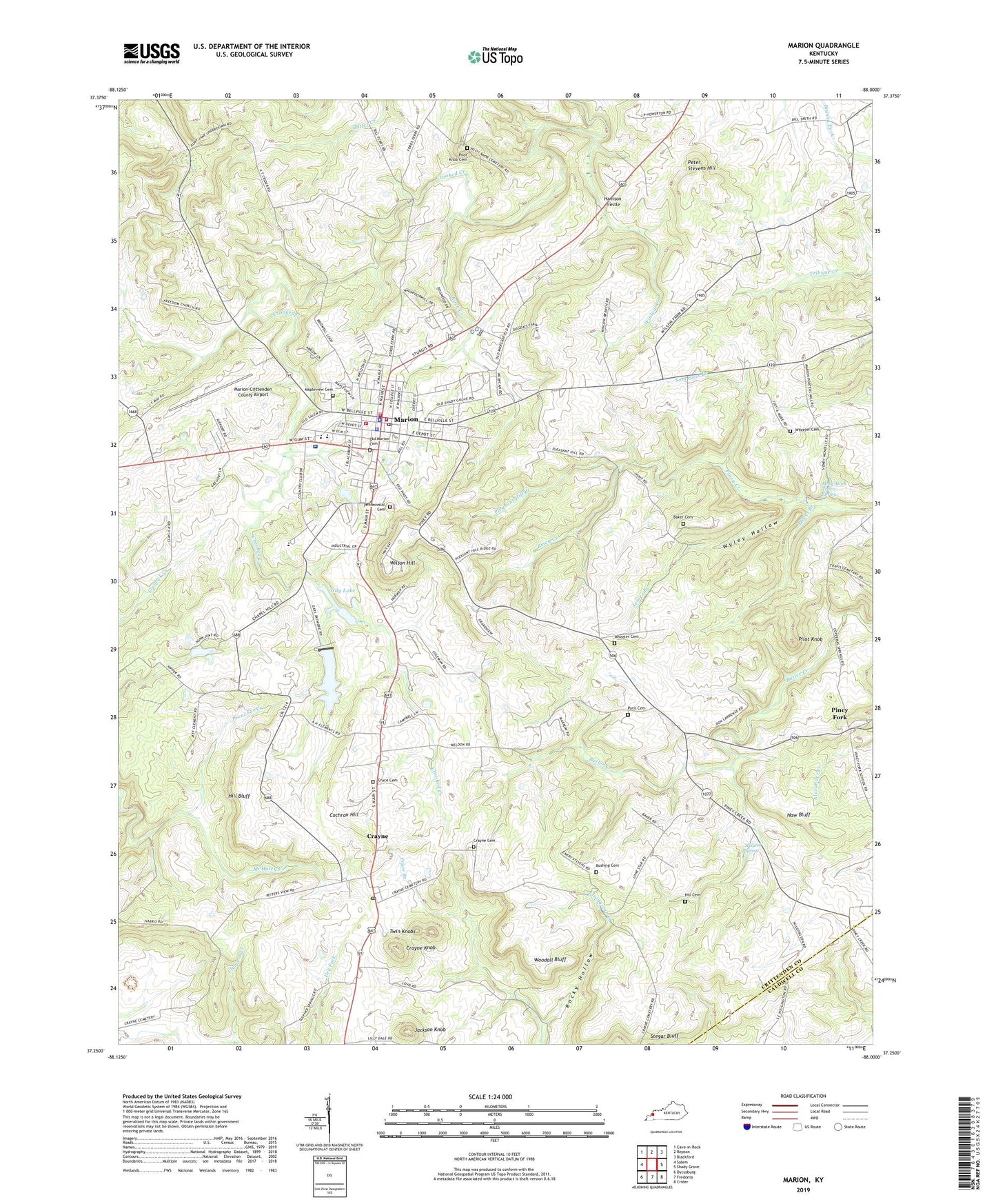
2022 topographic map quadrangle Marion in the state of Kentucky. Scale: 1:24000. Based on the newly updated USGS 7.5' US Topo map series, this map is in the following counties: Crittenden, Caldwell. The map contains contour data, water features, and other items you are used to seeing on USGS maps, but also has updated roads and other features. This is the next generation of topographic maps. Printed on high-quality waterproof paper with UV fade-resistant inks.
Quads adjacent to this one:
West: Salem
Northwest: Cave-in-Rock
North: Repton
Northeast: Blackford
East: Shady Grove
Southeast: Crider
South: Fredonia
Southwest: Dycusburg
This map covers the same area as the classic USGS quad with code o37088c1.
Contains the following named places: Aunt Jane Underdown Tabernacle, Baker Cemetery, Blacks Branch, Burned Courthouses Historical Marker, Chapel Hill Presbyterian Church, Chapel Hill Presbyterian Church Historical Marker, City Lake, City of Marion, Cochran Hill, Crayne, Crayne Cemetery, Crayne Census Designated Place, Crayne Knob, Crayne Post Office, Crittenden County, Crittenden County Courthouse Historical Marker, Crittenden County DES and Rescue Squad, Crittenden County Emergency Medical Services, Crittenden County Fire Department, Crittenden County High School, Crittenden County Hospital, Crittenden County Sheriff's Office, Crooked Creek, Crooked Creek Church, Cruce Branch, Cruce Cemetery, Doctor Forrest Carlisle Pogue Junior Historical Marker, F Julius Fohs Historical Marker, Freedom Church, Freedom School, Harrison Trestle, Haw Bluff, Hill Bluff, Hill Cemetery, Illinois Central Main Line Historical Marker, Jackson Knob, James Branch, John Jordan Crittenden Historical Marker, Judge Thomas Jefferson Nunn Historical Marker, Lone Star School, Mapleview Cemetery, Marion, Marion Division, Marion Fire Department, Marion Police Department, Marion Post Office, Marion-Crittenden County Airport, Mary Mark Travis Spring, McHaley Creek, Medical Spring, Nathan Bedford Forrests Foraging Mission Historical Marker, Oak Grove School, Old Marion Cemetery, Paris Cemetery Number 1, Pentecostal Cemetery, Peter Stevens Hill, Pilot Knob, Pilot Knob Cemetery, Piney Creek Church, Piney Fork, Pleasant Hill, Pleasant Hill Branch, Pleasant Hill Church, Rocky Hollow, Rush Creek, Rushing Cemetery, Sam Gass Branch, Senator W J Deboe Historical Marker, Stegar Bluff, Twin Knobs, Wheeler Cemetery, Wilson Hill, Winlow Creek, Winlow Park, WMJL-AM (Marion), Woodall Bluff, Wyley Hollow, ZIP Code: 42064