MyTopo
Fredonia Kentucky US Topo Map
Couldn't load pickup availability
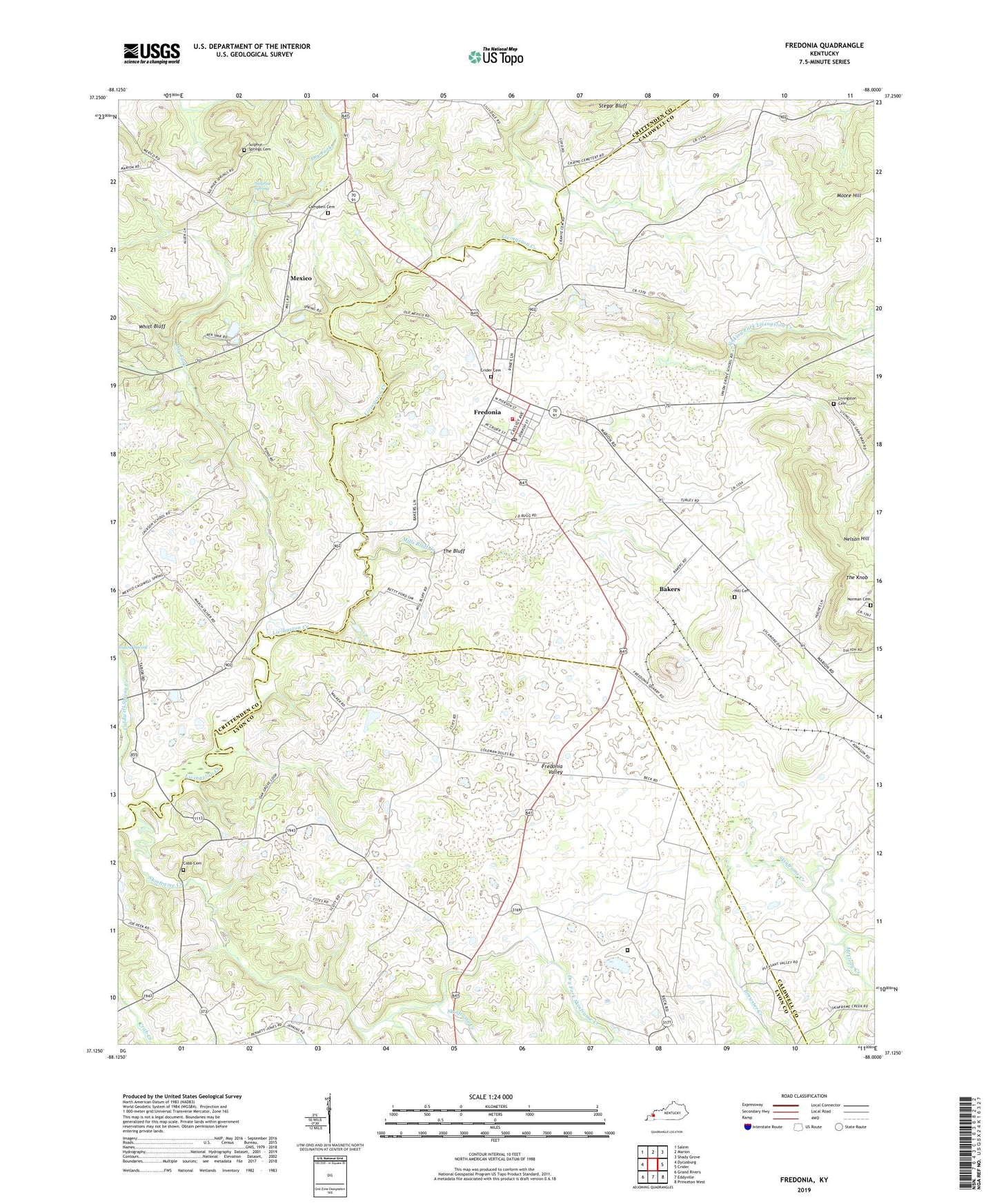
2022 topographic map quadrangle Fredonia in the state of Kentucky. Scale: 1:24000. Based on the newly updated USGS 7.5' US Topo map series, this map is in the following counties: Caldwell, Lyon, Crittenden. The map contains contour data, water features, and other items you are used to seeing on USGS maps, but also has updated roads and other features. This is the next generation of topographic maps. Printed on high-quality waterproof paper with UV fade-resistant inks.
Quads adjacent to this one:
West: Dycusburg
Northwest: Salem
North: Marion
Northeast: Shady Grove
East: Crider
Southeast: Princeton West
South: Eddyville
Southwest: Grand Rivers
This map covers the same area as the classic USGS quad with code o37088b1.
Contains the following named places: Bakers, Blue Mine, Brewster Creek, Campbell Cemetery, Centerville, Centerville Historical Marker, City of Fredonia, Cobb Cemetery, Crider African American Cemetery, Dry Fork, Dry Fork Skinframe Creek, Fredonia, Fredonia Fire Department, Fredonia Post Office, Fredonia Valley, Fredonia Valley Quarry, Haffaw Mine, Hebron Church, Hebron School, Hickory Grove, Hill Cemetery, Horseapple Creek, King Mine, Lilydale, Livingston, Livingston Cemetery, McElroy Creek, Mexico, Mexico School, Mills Bluff Creek, Moore Hill, New Bethel Church, Norman Cemetery, Penn Salt Fluorite Mill, Pigmy Mines, Sinking Fork Livingston Creek, Skinframe Creek, State Penal Farm, Sulphur Spring, Sulphur Spring Church, Sulphur Springs Cemetery, Tabb Number 1 Mine, The Bluff, The Knob, Western Kentucky Correctional Complex, ZIP Code: 42411