MyTopo
Dycusburg Kentucky US Topo Map
Couldn't load pickup availability
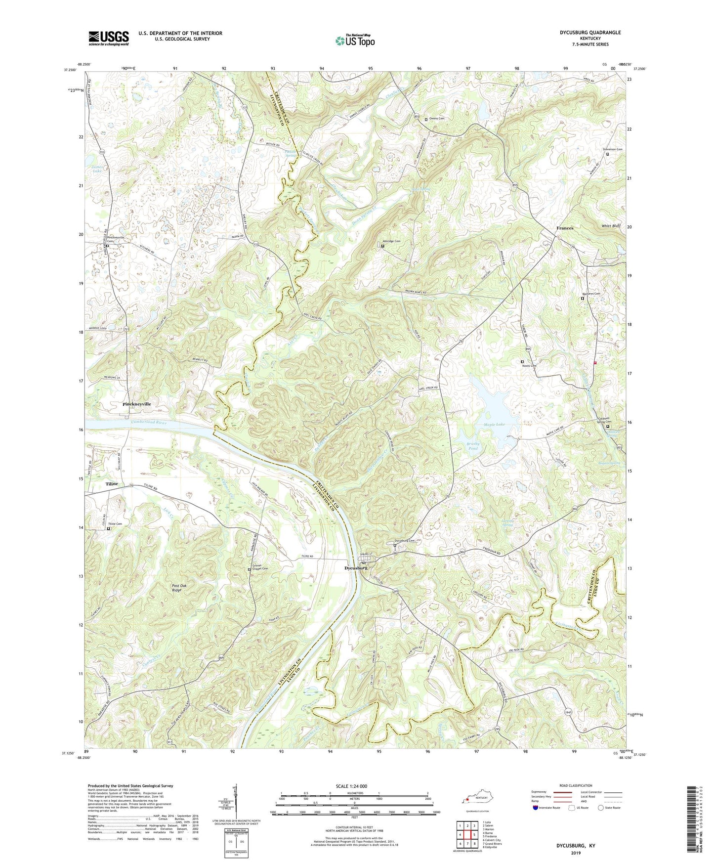
2022 topographic map quadrangle Dycusburg in the state of Kentucky. Scale: 1:24000. Based on the newly updated USGS 7.5' US Topo map series, this map is in the following counties: Crittenden, Livingston, Lyon. The map contains contour data, water features, and other items you are used to seeing on USGS maps, but also has updated roads and other features. This is the next generation of topographic maps. Printed on high-quality waterproof paper with UV fade-resistant inks.
Quads adjacent to this one:
West: Burna
Northwest: Lola
North: Salem
Northeast: Marion
East: Fredonia
Southeast: Eddyville
South: Grand Rivers
Southwest: Calvert City
This map covers the same area as the classic USGS quad with code o37088b2.
Contains the following named places: Asbridge Cemetery, Axel Creek, Billy Al Mine, Boaz School, Bogard Spring, Brushy Pond, Caldwell Spring, Caldwell Spring Creek, Caldwell Springs Cemetery, Caldwell Springs Volunteer Fire Department, City of Dycusburg, Claylick Creek, Cox Spring Branch, Crab Creek, Cypress Creek, Doan Spring, Doan Spring Creek, Dry Creek, Dycusburg, Dycusburg Cemetery, Dycusburg Post Office, Emmus Church, Frances, Grasen Mine, Green Mine, Groves Chapel, Groves Chapel Cemetery, Groves Chapel School, Harp Hollow Creek, Hodge Mine, Hulet Mine, James Lake, Kelley Mine, Koon Cemetery, Larping Spring, Livingston Creek, Maple Lake, Mary Helen Mine, Mathews Cemetery, Nancy Hanks Mine, New Bethel School, Number 18 Mine, Number 21 Mine, Number 22 Mine, Owens Cemetery, Owens School, Paddys Creek, Panther Creek, Pinckneyville, Pinckneyville Cemetery, Pinckneyville Church, Post Oak Ridge, Puckett Spring, Puckett Spring Creek, Red Mine, Reiter Mine, Seven Branch Church, Shelbys Store, Spring Creek, Stevenson Cemetery, Tiline, Tiline Cemetery, Tuckers Temple Church, Wadell Quarry, Whitt Bluff, ZIP Code: 42037