MyTopo
Glensboro Kentucky US Topo Map
Couldn't load pickup availability
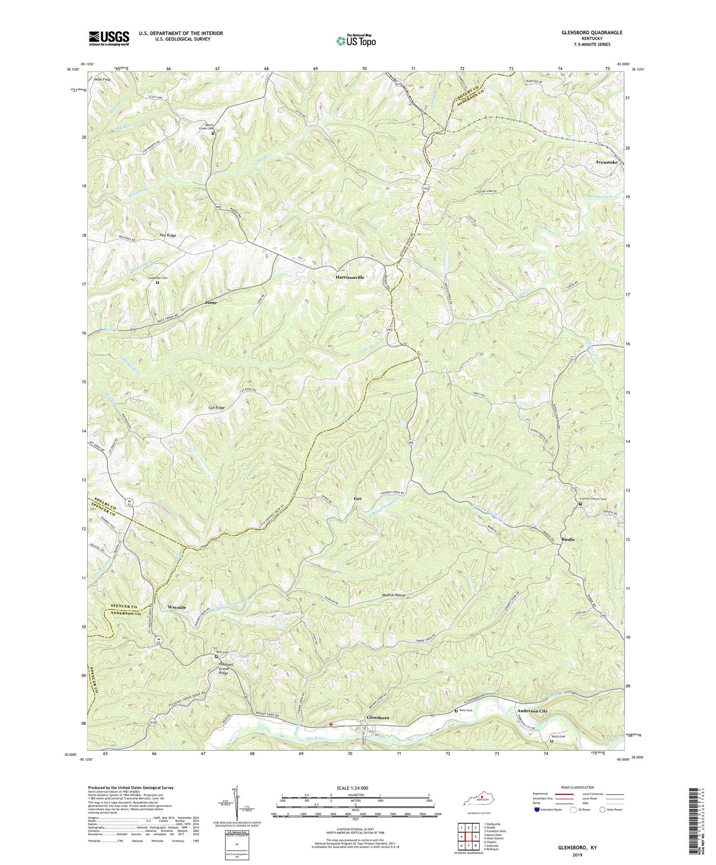
2022 topographic map quadrangle Glensboro in the state of Kentucky. Scale: 1:24000. Based on the newly updated USGS 7.5' US Topo map series, this map is in the following counties: Anderson, Shelby, Spencer. The map contains contour data, water features, and other items you are used to seeing on USGS maps, but also has updated roads and other features. This is the next generation of topographic maps. Printed on high-quality waterproof paper with UV fade-resistant inks.
Quads adjacent to this one:
West: Mount Eden
Northwest: Shelbyville
North: Waddy
Northeast: Frankfort West
East: Alton Station
Southeast: McBrayer
South: Ashbrook
Southwest: Chaplin
This map covers the same area as the classic USGS quad with code o38085a1.
Contains the following named places: Anderson City, Anderson County Fire District Station 3, Avenstoke, Avenstoke Railroad Station, Beech Creek Cemetery, Best Cemetery, Big Run, Birdie, Birdie Post Office, Bucy Cemetery, Carpenter Cemetery, Cat Ridge, Cat Ridge School, Corinth Christian Church, Corinth Church Cemetery, East Prong Crooked Creek, Gee, Gee Post Office, Glensboro, Glensboro Post Office, Glensboro School, Harrisonville, Harrisonville Post Office, Indian Creek, Junte, Marlowe School, Miles Field, Mount Vernon Church, Mudlick Hollow, Northwest Anderson Division, Pea Ridge School, Petty Cemetery, Petty Post Office, Pigeon Creek, Pigeon Fork Baptist Church, Pleasant Grove, Pleasant Grove Church, Pleasant Grove Ridge, Pleasant Grove School, Pleasant Hill Church, Salem Church, School Number Fifty-Nine, School Number Twenty-Five, Timber Creek, Wayside, Wayside Post Office, Wayside School, Wyskoffs Saw Mill, ZIP Code: 40076