MyTopo
Guthrie Kentucky US Topo Map
Couldn't load pickup availability
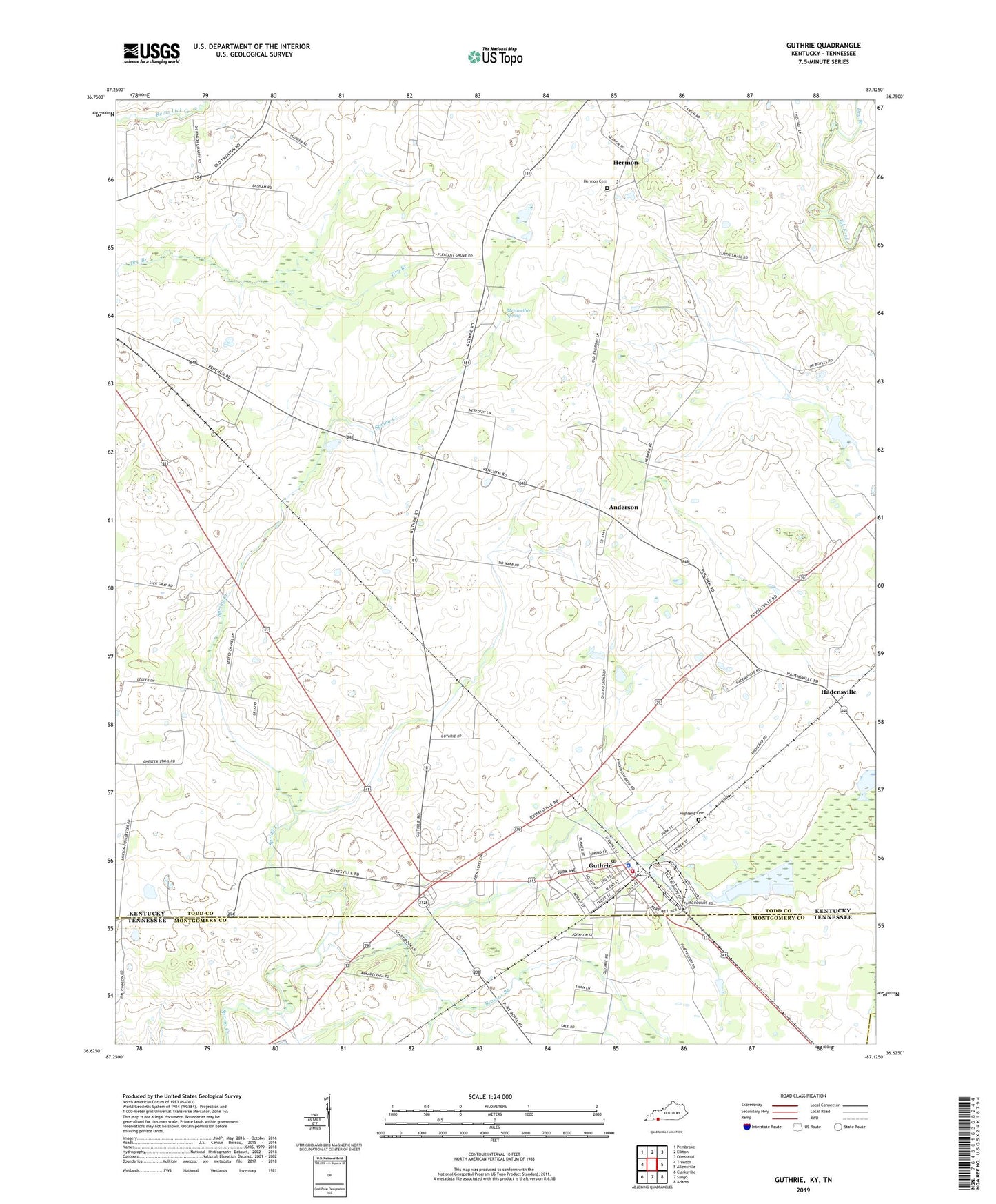
2022 topographic map quadrangle Guthrie in the states of Kentucky, Tennessee. Scale: 1:24000. Based on the newly updated USGS 7.5' US Topo map series, this map is in the following counties: Todd, Montgomery, Robertson. The map contains contour data, water features, and other items you are used to seeing on USGS maps, but also has updated roads and other features. This is the next generation of topographic maps. Printed on high-quality waterproof paper with UV fade-resistant inks.
Quads adjacent to this one:
West: Trenton
Northwest: Pembroke
North: Elkton
Northeast: Olmstead
East: Allensville
Southeast: Adams
South: Sango
Southwest: Clarksville
Contains the following named places: Anderson, Anderson School, Browns Branch, City of Guthrie, Dry Branch, Guthrie, Guthrie Division, Guthrie Fire Department, Guthrie Police Department, Guthrie Post Office, Hadensville, Hermon, Hermon Cemetery, Highland Cemetery, Lester Chapel, Meriwether Spring, Pinchem, Pleasant Grove Church, Robert Penn Warren Historical Marker, Stage Coach Inn Historical Marker, Tiny Town, Warfield School, ZIP Code: 42234