MyTopo
Trenton Kentucky US Topo Map
Couldn't load pickup availability
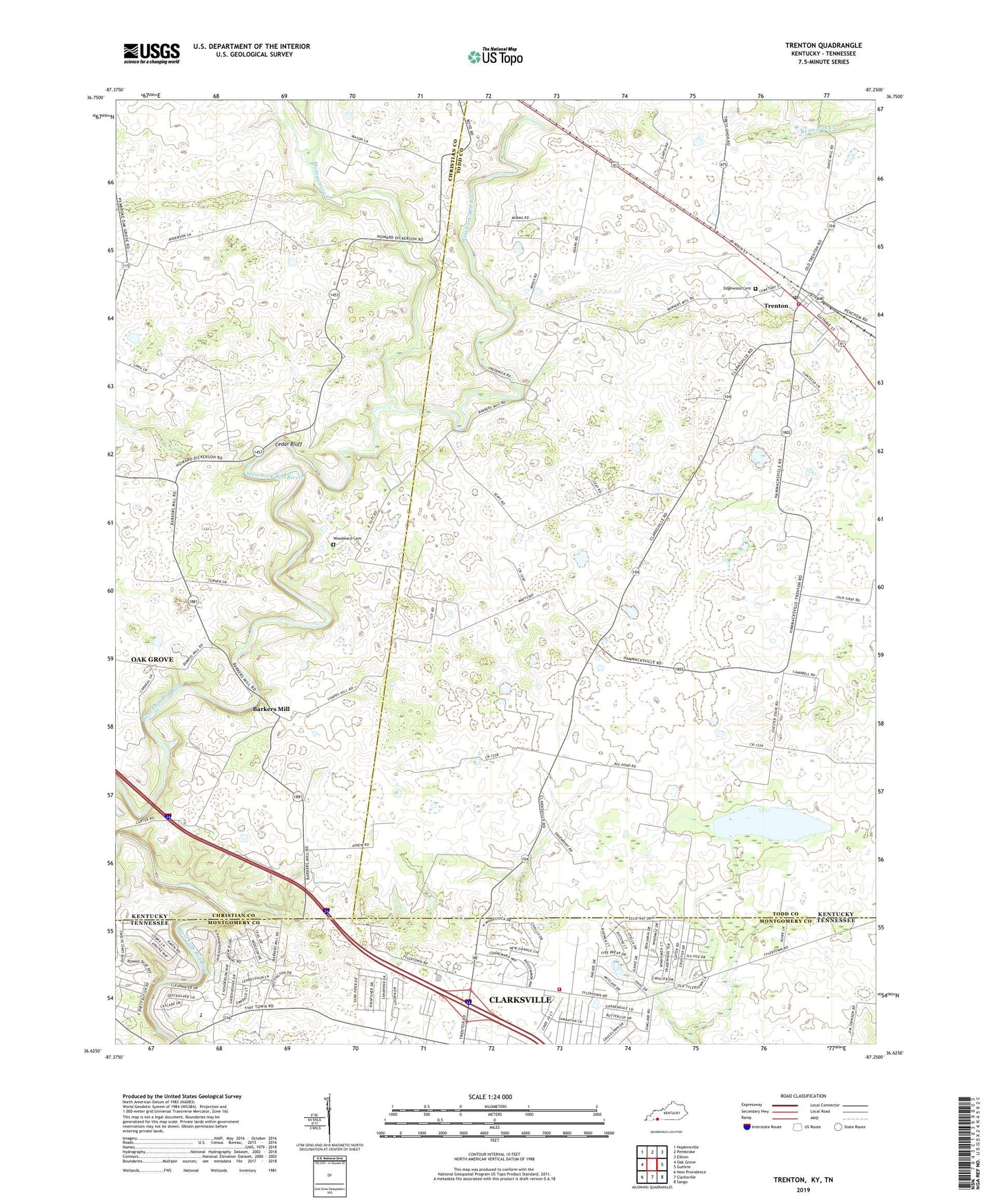
2022 topographic map quadrangle Trenton in the states of Kentucky, Tennessee. Scale: 1:24000. Based on the newly updated USGS 7.5' US Topo map series, this map is in the following counties: Todd, Christian, Montgomery. The map contains contour data, water features, and other items you are used to seeing on USGS maps, but also has updated roads and other features. This is the next generation of topographic maps. Printed on high-quality waterproof paper with UV fade-resistant inks.
Quads adjacent to this one:
West: Oak Grove
Northwest: Hopkinsville
North: Pembroke
Northeast: Elkton
East: Guthrie
Southeast: Sango
South: Clarksville
Southwest: New Providence
Contains the following named places: Barkers Mill, Big Pond, Cedar Bluff, Cedar Bluff Church, City of Trenton, Cloverlands, Commissioner District 18, Dry Branch, Edgewood Cemetery, Montgomery Creek, Peachers Mill, Pisgah Church, Reins Lick Creek, Trenton, Trenton Division, Trenton Post Office, Trenton Volunteer Fire Department, Woodward Cemetery, Zion, ZIP Codes: 42266, 42286