MyTopo
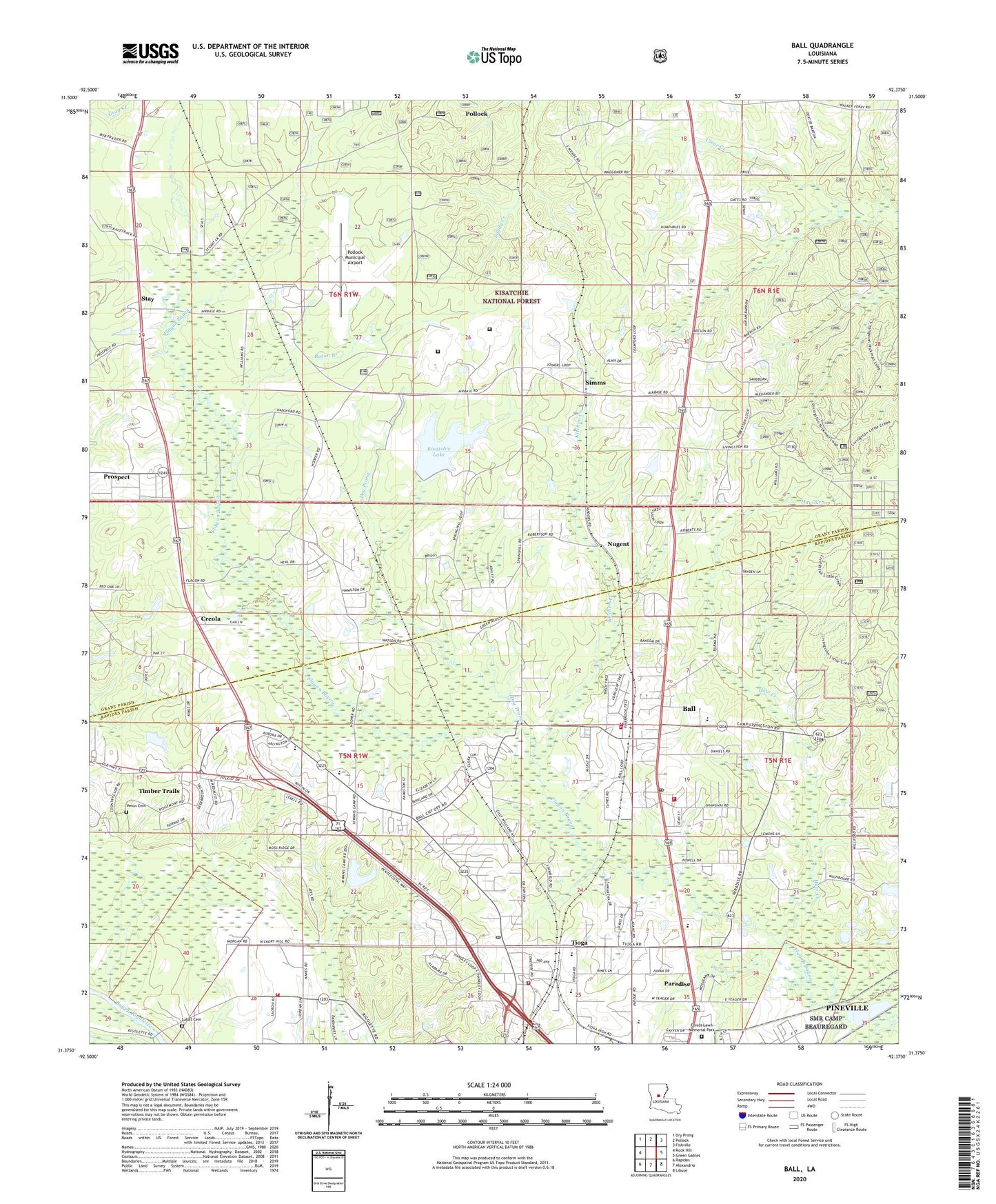
Ball Louisiana US Topo Map
Couldn't load pickup availability
Also explore the Ball Forest Service Topo of this same quad for updated USFS data
2024 topographic map quadrangle Ball in the state of Louisiana. Scale: 1:24000. Based on the newly updated USGS 7.5' US Topo map series, this map is in the following counties: Grant, Rapides. The map contains contour data, water features, and other items you are used to seeing on USGS maps, but also has updated roads and other features. This is the next generation of topographic maps. Printed on high-quality waterproof paper with UV fade-resistant inks.
Quads adjacent to this one:
West: Rock Hill
Northwest: Dry Prong
North: Pollock
Northeast: Fishville
East: Green Gables
Southeast: Libuse
South: Alexandria
Southwest: Rapides
This map covers the same area as the classic USGS quad with code o31092d4.
Contains the following named places: Alpine Christian School, Alpine Volunteer Fire Department Station 1, Alpine Volunteer Fire Department Station 2, Alpine Volunteer Fire Department Station 3, Apostolic Church, Bacon Branch, Ball, Ball Elementary School, Ball Post Office, Ball Town City Police Department, Ball Volunteer Fire Department Station 1, Ball Volunteer Fire Department Station 2, Ball Volunteer Fire Department Station 3, Bentley Church, Camp Cook, Catahoula Work Center, Central Church, Christian Chapel, Clear Creek Campground, Cornith Church, Dry Prong, Faith Baptist Church, Federal Correctional Institution Pollock, Garnett, Handley Loop Church, Haw Creek, Highland Church, Hosanna Baptist Church, Hudson Creek Church, Hudson Creek Siding, Jena Band of Choctaw Reservation, Kisatchie Lake, Kisatchie Lake Dam, Kitchen Creek, Kitchen Creek Church, KLAA-FM (Tioga), KWDF-AM (Ball), Labat Cemetery, Louisiana Noname Number 53 Dam, Louisiana State Industrial School, Louisiana Training Institute for Girls, Mary Goff Elementary School, Nugent, Paradise, Paradise Elementary School, Parish Governing Authority District 6, Parish Governing Authority District A, Pilgrim Church, Pinehurst Baptist Church, Pollock Army Air Field, Pollock Municipal Airport, Prospect, Prospect Census Designated Place, Rapides Parish Sheriff's Office Substation, Rigolette Ward Ten, Simms, South Sarepta Oil and Gas Field, Springhill Church, Stay, Timber Trails, Tioga, Tioga Elementary School, Tioga First Baptist Church, Tioga High School, Tioga Junior High School, Town of Ball, Town of Pollock, United Church, United States Penitentiary Pollock, Venus Cemetery, Village of Creola, Ward Eight, Wayside Church, ZIP Code: 71405