MyTopo
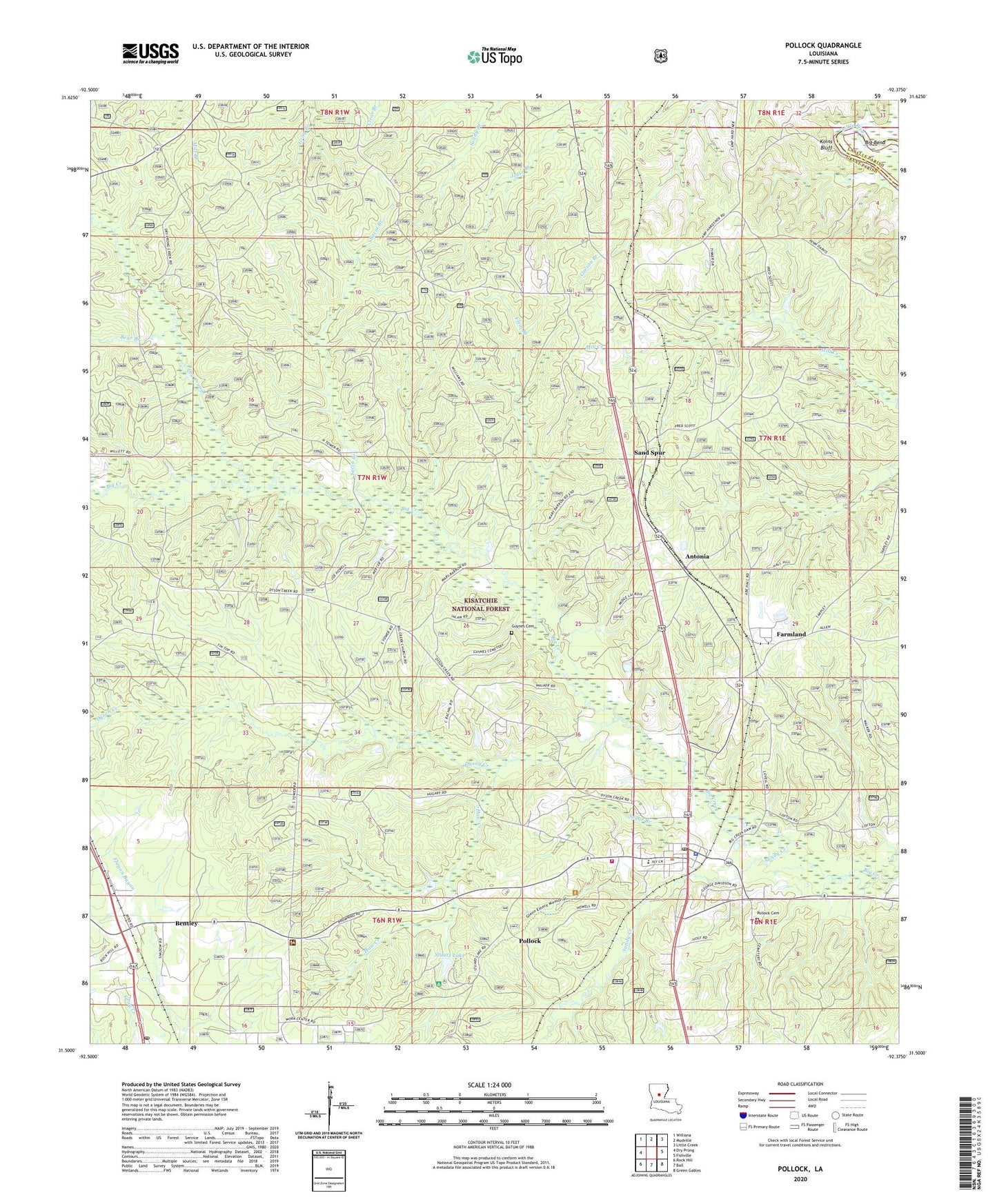
Pollock Louisiana US Topo Map
Couldn't load pickup availability
Also explore the Pollock Forest Service Topo of this same quad for updated USFS data
2024 topographic map quadrangle Pollock in the state of Louisiana. Scale: 1:24000. Based on the newly updated USGS 7.5' US Topo map series, this map is in the following counties: Grant, LaSalle. The map contains contour data, water features, and other items you are used to seeing on USGS maps, but also has updated roads and other features. This is the next generation of topographic maps. Printed on high-quality waterproof paper with UV fade-resistant inks.
Quads adjacent to this one:
West: Dry Prong
Northwest: Williana
North: Mudville
Northeast: Little Creek
East: Fishville
Southeast: Green Gables
South: Ball
Southwest: Rock Hill
This map covers the same area as the classic USGS quad with code o31092e4.
Contains the following named places: Antonia, Antonia Lookout Tower, Bear Branch, Bentley, Bentley Post Office, Big Creek Baptist Church, Big Creek School, Big Rock Church, Camp Grant Walker, Catahoula Lookout Tower, Catahoula Ranger District Office, Church of God State Camp, Dry Prong, Dyson Creek, Farmland, Flem Branch, Grant Parish District 5 Volunteer Fire Department, Guynes Cemetery, Haw Creek, Koins Bluff, Parish Governing Authority District 7, Pleasant Hill Church, Pollock, Pollock Baptist Church, Pollock Cemetery, Pollock Elementary School, Pollock High School, Pollock Police Department, Pollock Post Office, Sand Spur, Sandy Creek, Socia Branch, Stuart Lake, Stuart Lake Dam, Stuart Lake Recreation Site, Stuart Pine Seed Orchard, Sugar Branch, ZIP Codes: 71407, 71467