MyTopo
Libuse Louisiana US Topo Map
Couldn't load pickup availability
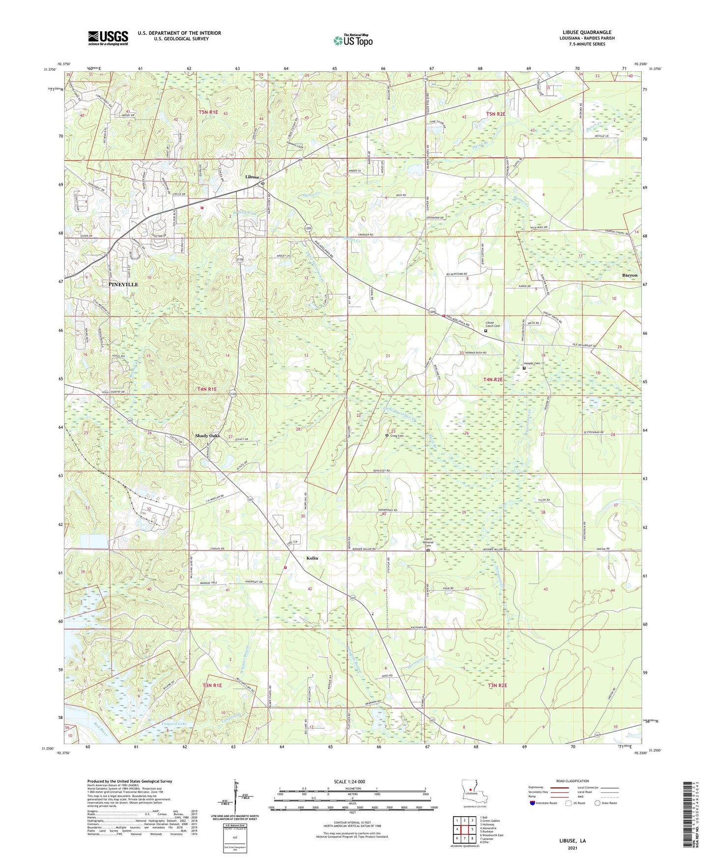
2024 topographic map quadrangle Libuse in the state of Louisiana. Scale: 1:24000. Based on the newly updated USGS 7.5' US Topo map series, this map is in the following counties: Rapides. The map contains contour data, water features, and other items you are used to seeing on USGS maps, but also has updated roads and other features. This is the next generation of topographic maps. Printed on high-quality waterproof paper with UV fade-resistant inks.
Quads adjacent to this one:
West: Alexandria
Northwest: Ball
North: Green Gables
Northeast: Holloway
East: Buckeye
Southeast: Effie
South: Latanier
Southwest: Woodworth East
This map covers the same area as the classic USGS quad with code o31092c3.
Contains the following named places: Barron School, Black Branch, Brushy Fork, Buckeye Ward Eleven, Buttonwood Lake, Carmel Baptist Church, Cedar Grove School, Craig Cemetery, Craig Tabernacle, Czech National Cemetery, Holiday Village Volunteer Fire Department, Holiday Village Volunteer Fire Department District 4 Station 4, Hooper Cemetery, Kolin, Kolin Baptist Church, Libuse, Libuse Lookout Tower, Libuse Post Office, Little Horsepen Creek, Moller, Palmer Church, Parish Governing Authority District B, Philadelphia Baptist Church, Philadelphia Baptist Church Cemetery, Philadelphia School, Rock Island Lake, Ruby - Kolan Volunteer Fire Department, Ruby - Wise Elementary School, Saints Francis and Ann Church, Shady Oaks, Tanyard Branch, Tanyard Lake, Wise School, ZIP Code: 71360