MyTopo
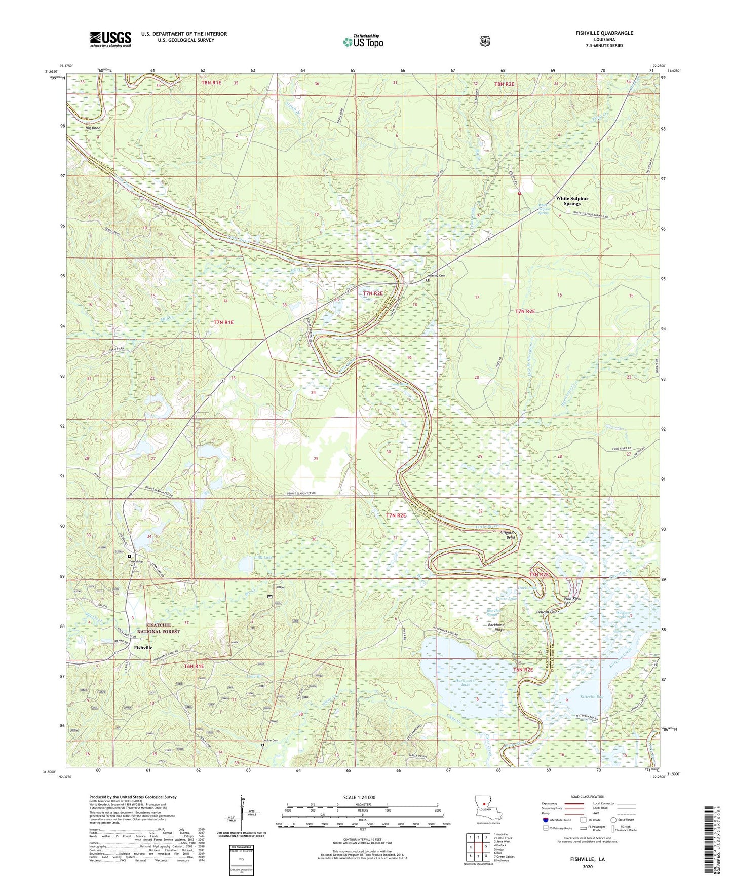
Fishville Louisiana US Topo Map
Couldn't load pickup availability
Also explore the Fishville Forest Service Topo of this same quad for updated USFS data
2024 topographic map quadrangle Fishville in the state of Louisiana. Scale: 1:24000. Based on the newly updated USGS 7.5' US Topo map series, this map is in the following counties: Grant, LaSalle. The map contains contour data, water features, and other items you are used to seeing on USGS maps, but also has updated roads and other features. This is the next generation of topographic maps. Printed on high-quality waterproof paper with UV fade-resistant inks.
Quads adjacent to this one:
West: Pollock
Northwest: Mudville
North: Little Creek
Northeast: Jena West
East: Nebo
Southeast: Holloway
South: Green Gables
Southwest: Ball
This map covers the same area as the classic USGS quad with code o31092e3.
Contains the following named places: Alligator Bend, Alligator Brake, Backbone Ridge, Big Bend, Big Branch, Big Creek, Blue Hole Slough, Camp Mary Lee, Camp Windywood, Duck Lake, Eden Fellowship Volunteer Fire Department Station 2, Fishville, Fishville Post Office, Fool River, Fool River Bend, Friendship Baptist Church, Friendship Cemetery, Goose Lake, Gotch Branch, Hardwater Lake, Hurricane Creek, Jena Band of Choctaw Tribal Designated Statistical Area, Kitterlin Bay, Kitterlin Creek, Leckie Cemetery, Lick Branch Hurricane Creek, Lind Lake, Long Brake, Long Branch, Lynn Lake Dam, Mack Branch, Manistee, Mill Creek, Parish Governing Authority District 8, Pelican Point, Thompson Ferry, Thompsons Ferry, Trout Creek, Walkers Ferry, Whatley Cemetery, White Sulphur Spring, White Sulphur Springs