MyTopo
Bayou Cocodrie Louisiana US Topo Map
Couldn't load pickup availability
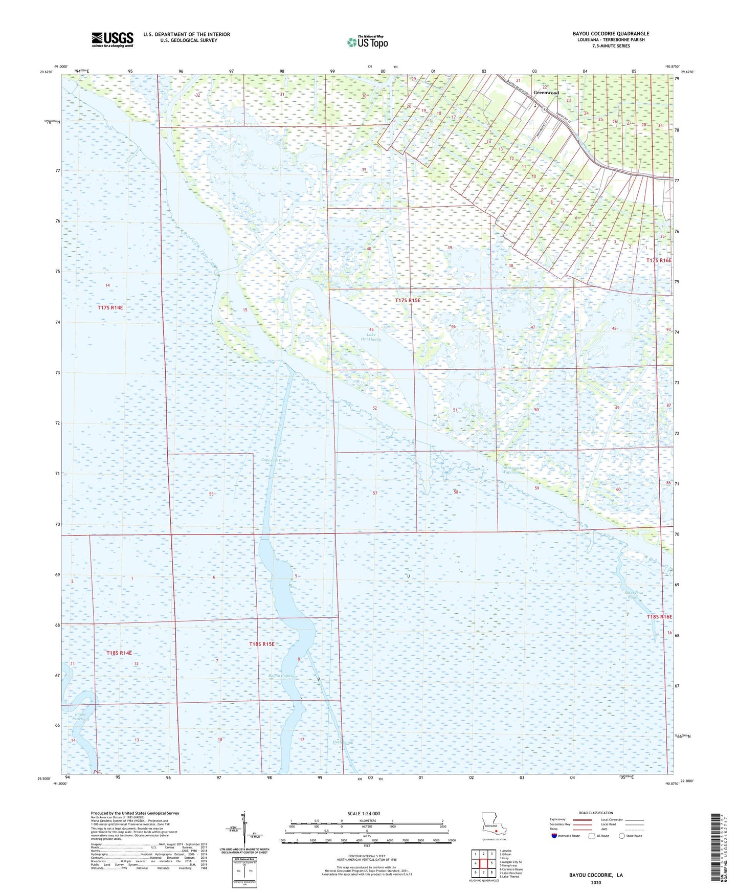
2024 topographic map quadrangle Bayou Cocodrie in the state of Louisiana. Scale: 1:24000. Based on the newly updated USGS 7.5' US Topo map series, this map is in the following counties: Terrebonne. The map contains contour data, water features, and other items you are used to seeing on USGS maps, but also has updated roads and other features. This is the next generation of topographic maps. Printed on high-quality waterproof paper with UV fade-resistant inks.
Quads adjacent to this one:
West: Morgan City SE
Northwest: Amelia
North: Gibson
Northeast: Gray
East: Humphreys
Southeast: Lake Theriot
South: Lake Penchant
Southwest: Carencro Bayou
This map covers the same area as the classic USGS quad with code o29090e8.
Contains the following named places: Bayou Copasaw, Bayou Copasaw Gas Field, Copasaw Canal, East Gibson Gas and Oil Field, Gibson Oil Field, Greenwood, Greenwood Middle School, Huth Canal, Lake Cocodrie, Lake Hackberry, Mount Pilgrim Church, Northeast Gibson Oil Field, Saint Bayou Gas Field, Saint Paul Bayou, South Humphreys Gas Field