MyTopo
Humphreys Louisiana US Topo Map
Couldn't load pickup availability
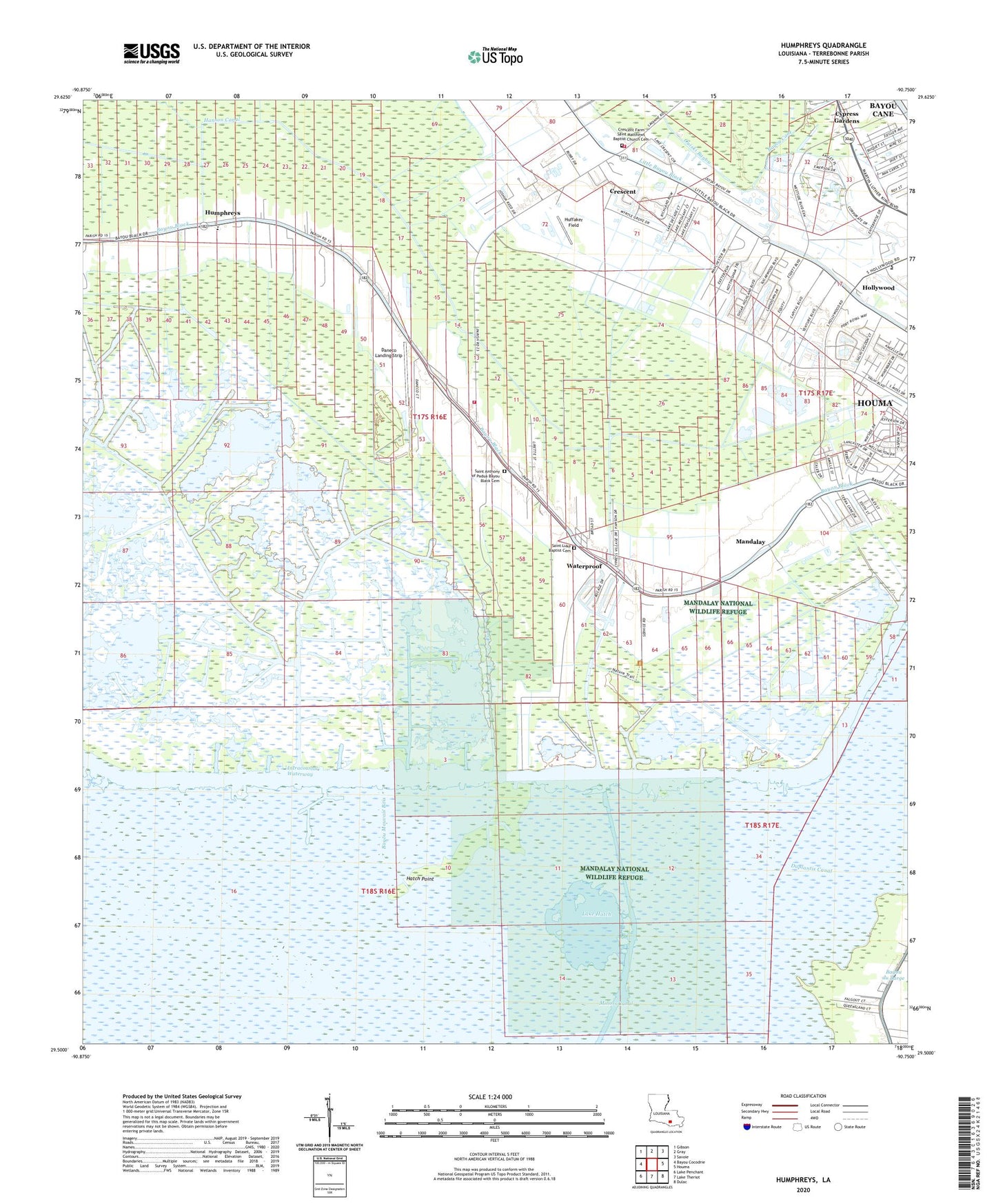
2024 topographic map quadrangle Humphreys in the state of Louisiana. Scale: 1:24000. Based on the newly updated USGS 7.5' US Topo map series, this map is in the following counties: Terrebonne. The map contains contour data, water features, and other items you are used to seeing on USGS maps, but also has updated roads and other features. This is the next generation of topographic maps. Printed on high-quality waterproof paper with UV fade-resistant inks.
Quads adjacent to this one:
West: Bayou Cocodrie
Northwest: Gibson
North: Gray
Northeast: Savoie
East: Houma
Southeast: Dulac
South: Lake Theriot
Southwest: Lake Penchant
Contains the following named places: Bayou Black Elementary School, Bayou Black Volunteer Fire Department, Bayou Cane, Bayou Cane Census Designated Place, Crescent, Crescent Farms Oil and Gas Field, Daneco Landing Strip, Duplantis Canal, Hanson Canal, Hatch Point, Hollywood, Hollywood Oil and Gas Field, Huffaker Field, Humphreys, Humphreys Oil and Gas Field, Lake Hatch, Lake Hatch Oil and Gas Field, Mandalay, Mandalay National Wildlife Refuge, Maria Immacolata Church, Orange Grove Oil and Gas Field, Ouiski Bayou, Parish Governing Authority District J, Saint Anthonys Church, Saint Lukes Church, Sunrise Oil and Gas Field, The Church of Jesus Christ of Latter Day Saints, United Houma Nation State Designated Tribal Statistical Area, Ward Nine, Ward Two, Waterproof, ZIP Code: 70360