MyTopo
Lake Theriot Louisiana US Topo Map
Couldn't load pickup availability
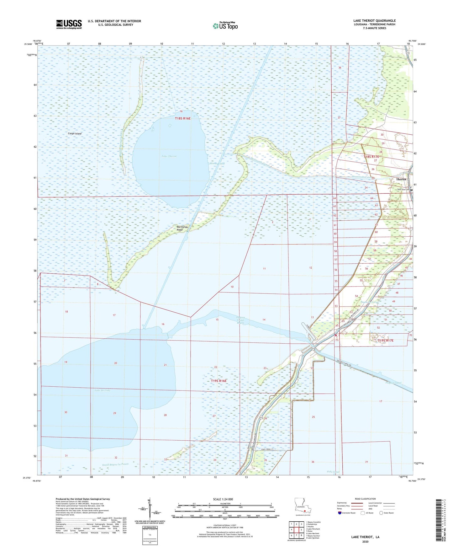
2024 topographic map quadrangle Lake Theriot in the state of Louisiana. Scale: 1:24000. Based on the newly updated USGS 7.5' US Topo map series, this map is in the following counties: Terrebonne. The map contains contour data, water features, and other items you are used to seeing on USGS maps, but also has updated roads and other features. This is the next generation of topographic maps. Printed on high-quality waterproof paper with UV fade-resistant inks.
Quads adjacent to this one:
West: Lake Penchant
Northwest: Bayou Cocodrie
North: Humphreys
Northeast: Houma
East: Dulac
Southeast: Lake Quitman
South: Bayou Sauveur
Southwest: Lake Mechant
This map covers the same area as the classic USGS quad with code o29090d7.
Contains the following named places: Bayou Dularge Fire Department, Congo Island, Du Large Gas Field, East Lake De Cade Gas Field, Falgout Canal, Falgout Canal Bayou, Falgout Canal Marina, Lake De Cade, Lake Theriot, Lower Bayou du Large School, Marmande Canal, Marmande Ridge, Minors Canal, South Sunrise Oil and Gas Field, Southdown Primary Elementary School, Theriot, Ward Ten, ZIP Code: 70397