MyTopo
Belmont Louisiana US Topo Map
Couldn't load pickup availability
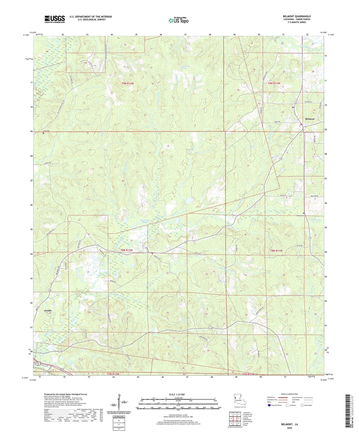
2024 topographic map quadrangle Belmont in the state of Louisiana. Scale: 1:24000. Based on the newly updated USGS 7.5' US Topo map series, this map is in the following counties: Sabine. The map contains contour data, water features, and other items you are used to seeing on USGS maps, but also has updated roads and other features. This is the next generation of topographic maps. Printed on high-quality waterproof paper with UV fade-resistant inks.
Quads adjacent to this one:
West: Zwolle
Northwest: Converse
North: Pleasant Hill
Northeast: Hollis Creek
East: Marthaville
Southeast: Many
South: Loring
Southwest: Beech Bayou
This map covers the same area as the classic USGS quad with code o31093f5.
Contains the following named places: Bayou Scie, Bayou Scie Methodist Church, Bayou Scie School, Beaverdam Slough, Belmont, Belmont Baptist Church, Belmont Census Designated Place, Belmont Post Office, Belmont Union Christian Academy School, Bethesda Church, Brushy Creek, Carson Church, East Sardis Oil and Gas Field, Hamlin, Hamlin School, Linn Cemetery, Little Bayou Scie, Little San Miguel Creek, North Fork San Miguel Creek, North Sabine Fire Protection District Bayou Scie Station, North Sabine Fire Protection District Belmont Station, Parish Governing Authority District 8, Smithfield Church, Snake Creek, Sneed Creek, The Big Woods, Thorner Lick Creek, Turpentine Spring, Ward Nine, White Lick Creek, Wofed Cemetery, ZIP Codes: 71406, 71486