MyTopo
Pleasant Hill Louisiana US Topo Map
Couldn't load pickup availability
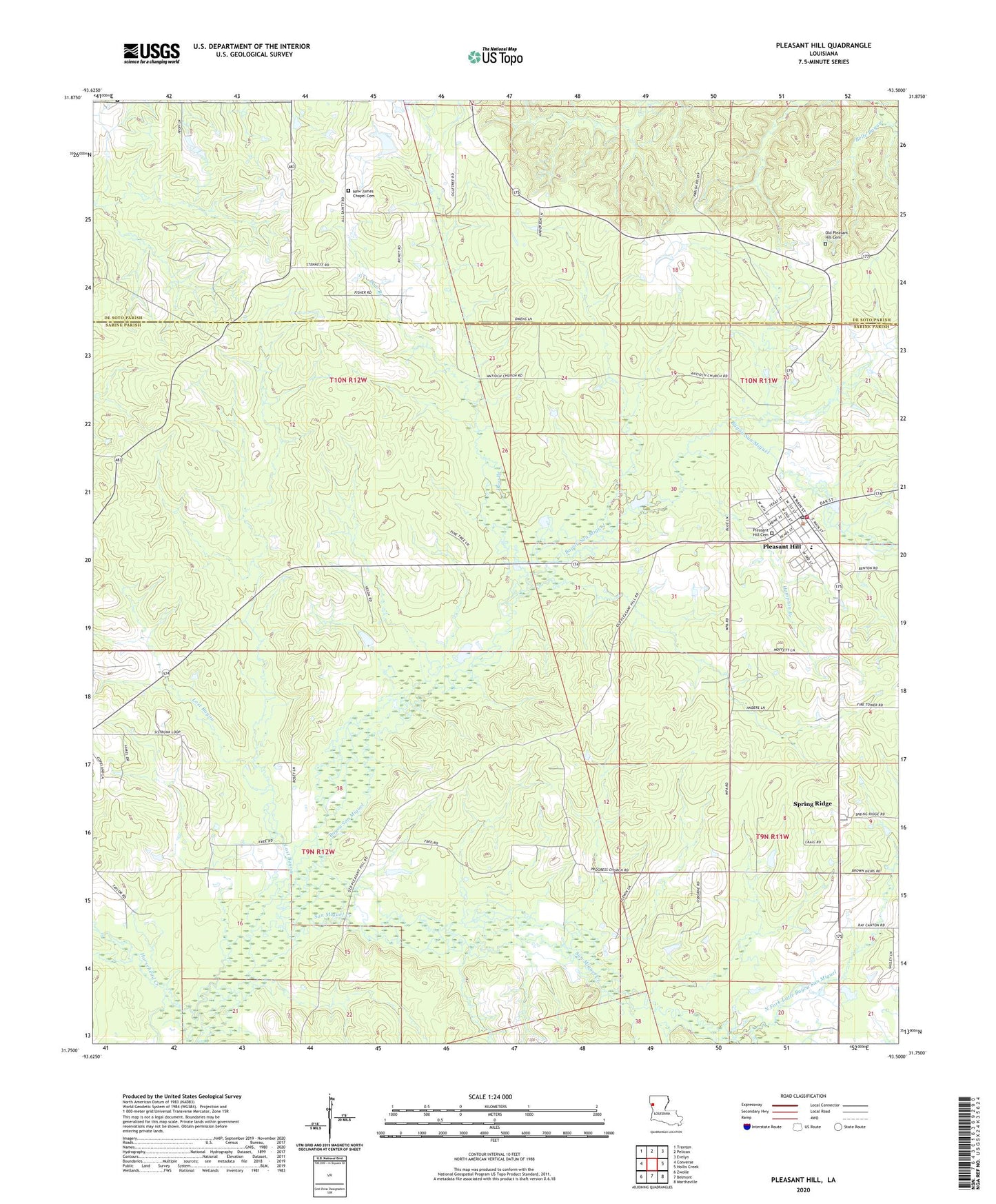
2024 topographic map quadrangle Pleasant Hill in the state of Louisiana. Scale: 1:24000. Based on the newly updated USGS 7.5' US Topo map series, this map is in the following counties: Sabine, De Soto. The map contains contour data, water features, and other items you are used to seeing on USGS maps, but also has updated roads and other features. This is the next generation of topographic maps. Printed on high-quality waterproof paper with UV fade-resistant inks.
Quads adjacent to this one:
West: Converse
Northwest: Trenton
North: Pelican
Northeast: Evelyn
East: Hollis Creek
Southeast: Marthaville
South: Belmont
Southwest: Zwolle
This map covers the same area as the classic USGS quad with code o31093g5.
Contains the following named places: Antioch Church, Arbor Spring Church, Daw Branch, Green Chapel, Hampton Branch, Horsehead Creek, Lost Bayou, North Fork Little Bayou San Miguel, North Sabine Fire Protection District Pleasant Hill Station, Old Pleasant Hill, Old Pleasant Hill Cemetery, Parish Governing Authority District 9, Pleasant Hill, Pleasant Hill Cemetery, Pleasant Hill High School, Pleasant Hill Post Office, Progress Church, Progress School, San Miguel Creek, San Miquel Bayou Oil and Gas Field, Spring Ridge, Spring Ridge Gas Field, Spring Ridge School, Village of Pleasant Hill, Ward Seven, ZIP Code: 71065