MyTopo
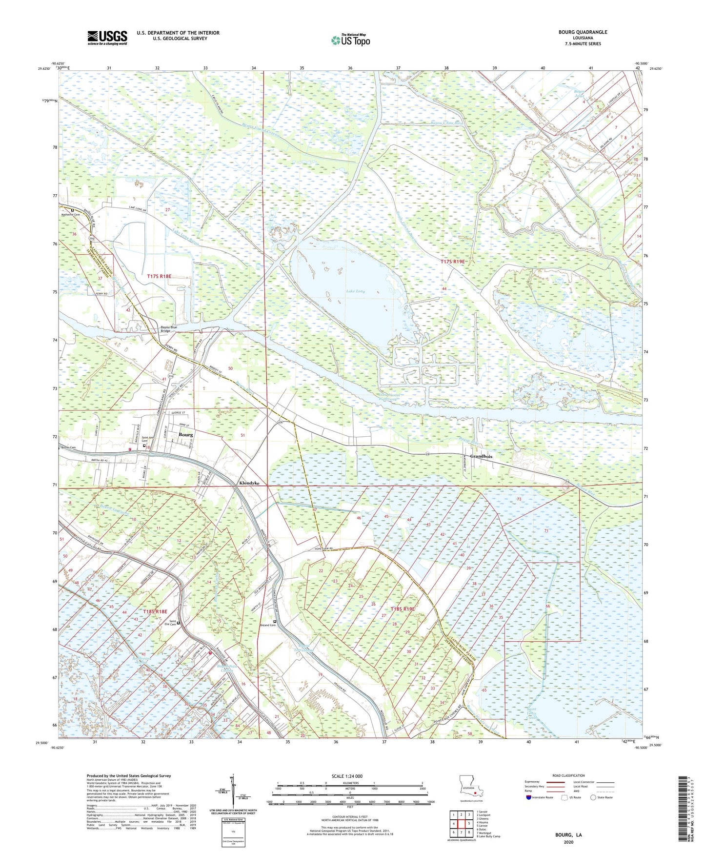
Bourg Louisiana US Topo Map
Couldn't load pickup availability
2024 topographic map quadrangle Bourg in the state of Louisiana. Scale: 1:24000. Based on the newly updated USGS 7.5' US Topo map series, this map is in the following counties: Lafourche, Terrebonne. The map contains contour data, water features, and other items you are used to seeing on USGS maps, but also has updated roads and other features. This is the next generation of topographic maps. Printed on high-quality waterproof paper with UV fade-resistant inks.
Quads adjacent to this one:
West: Houma
Northwest: Savoie
North: Lockport
Northeast: Gheens
East: Larose
Southeast: Lake Bully Camp
South: Montegut
Southwest: Dulac
This map covers the same area as the classic USGS quad with code o29090e5.
Contains the following named places: Aragon Plantation, Bayou Blue Bridge, Bayou Blue Church, Bayou Blue School, Bayou Blue United Methodist Church, Bayou Grand Coteau, Bayou Jollet, Bisland Cemetery, Bourg, Bourg Baptist Mission Church, Bourg Census Designated Place, Bourg Elementary School, Bourg Gas Field, Bourg Volunteer Fire Department, Carpentier Mission, Chauvin School, Eagle Island Bayou, Grandbois, Klondyke, Lake Long, Lake Long Bayou, Lake Long Oil and Gas Field, Little Caillou Volunteer Fire Department Station 1 Upper Station, Matherne Cemetery, North Montegut Gas Field, Parish Governing Authority District 11, Parish Governing Authority District 5, Saint Ann Cemetery, Saint Ann Church, Saint Anns Chapel, Saint Elie Cemetery, Saint Peters Church, Terrebonne Parish Library Bourg Branch, The Methodist Church, Vision Christian Center, Ward Five, Ward Four, ZIP Codes: 70343, 70374